Wednesday, October 18
46 degrees this morning, but sun's out! Leisurely morning, breakfast and showers and then we head northeast, toward Canada. The coast of Maine really does go east-northeast rather than true north.
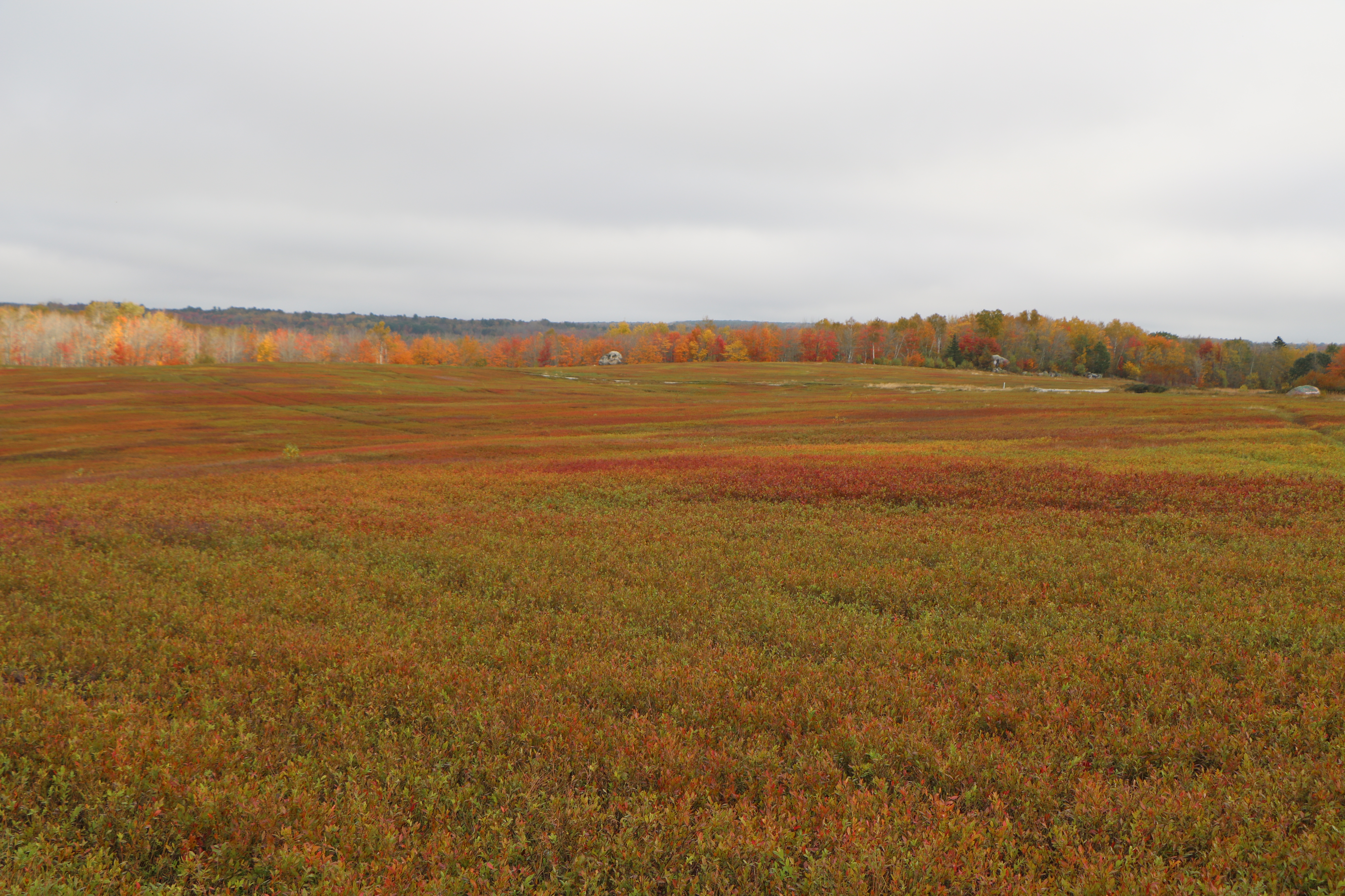
We pass through the town of Cherryfield which is an area with lots of blueberry barrens. We stop and ask a few women at an antique shop where we can see the barrens, since they are supposed to be colorful in the Fall. Following their directions, we drive out of town a bit and finally the road turns to dirt and we see acres of blueberry plants before us. The plants are short -


maybe 6" tall - wild plants which are now a mix of red, yellow and green. (They produce berries, small but sweet, which are harvested in late July to early September with a special rake.) Sandy soil and frequent fog are believed to contribute to the high quality of berries.
No berries now, of course, and one of the women said the color is a bit past its peak, but still pretty. She also warned that it is easy to get lost out there "in the barrens". Sounds like a good setting for a spooky movie. We agree and this porcupine seems to be enjoying the plants, even without berries! Couldn't get him to lift his head as he munched away.

We pass some pretty fall colors here and there as we continue on.
We finally reach the town of Lubec and cross the Franklin Delano Roosevelt Memorial Bridge into Canada. Border stop was short and sweet and the first lighthouse was right there.
Mulholland Point Lighthouse is in New Brunswick near the southern end of Campobello Island, to guide vessels through Lubec Narrows, the small passage between the island and the US mainland. It was completed in 1884. It is now part of Roosevelt Campobello International Park, operated jointly by the US and Canada.

The blue sky makes the nearby water look beautiful.
From here it is a short drive to Campobello - the Roosevelt Cottage, a 34-room house that has been restored to the it's early 1900's look, which is when FDR and his family spent their summers here.
 |
| The Roosevelt "Cottage" |
The island is only 10 miles long and sits in the Bay of Fundy where FDR loved to sail. There is a short film at the visitor's center and a free tour of the "cottage" which is 95% original, including many of the Roosevelt's personal items. We have a lovely guide named Elizabeth.
This was Eleanor's desk.
It was here that FDR was stricken with polio, though they've determined he got it at a Scout Jamboree - I think in New York. He did not visit often after becoming ill, but Eleanor often came here in the Summer with their children.
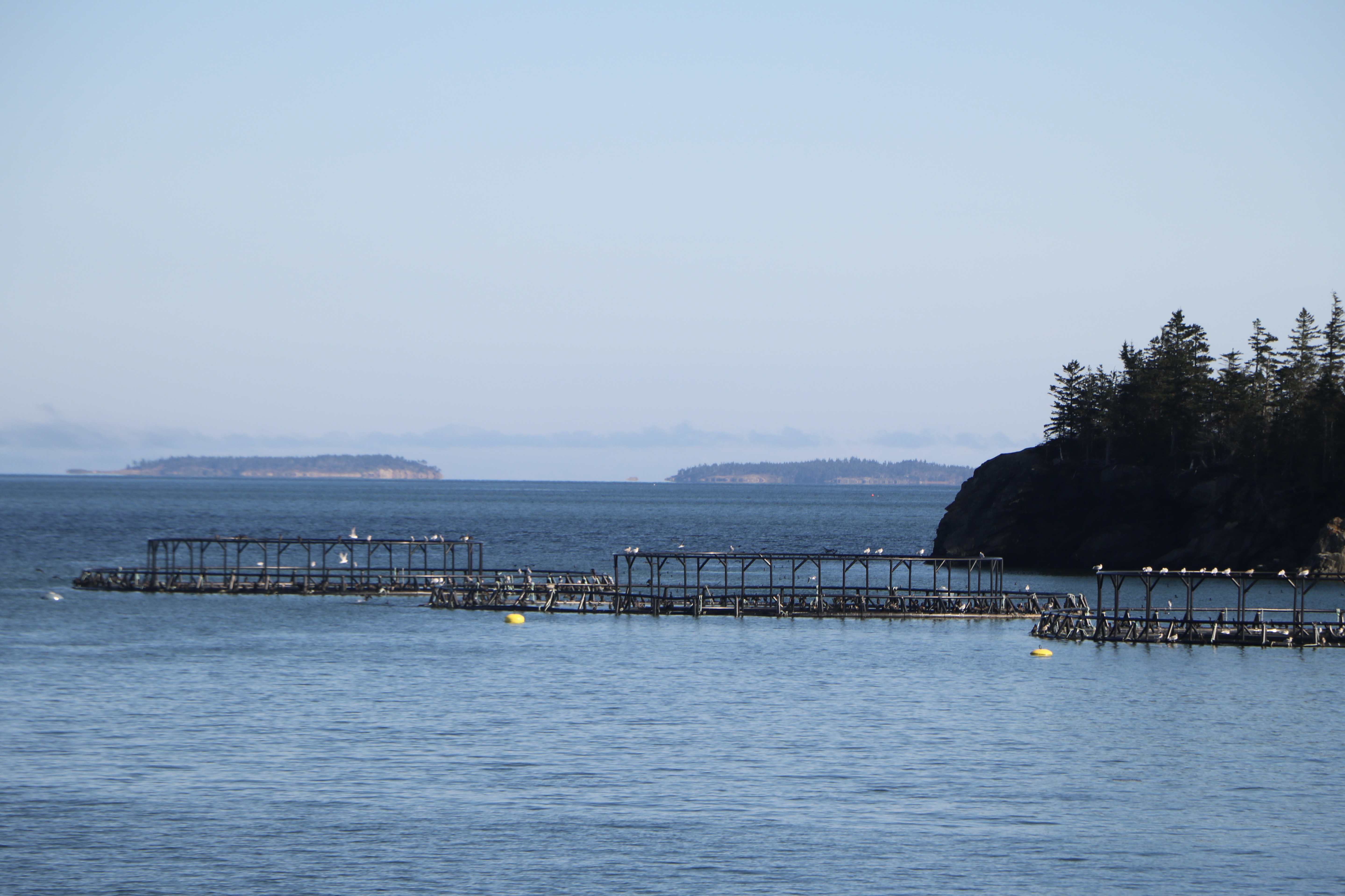
After this, we drive out to the end of the island, noting salmon farming along the way.

At the tip of the island is Head Harbor Lightstation (also known as the East Quoddy Light).

It is unusual in that it is marked with a large St. George's cross - hard to see from our viewpoint. It was built in 1829, one of the oldest in Canada, and guides ships entering the Passamaquoddy Bay through Head Harbor Passage. As part of the Bay of Fundy, there are large tides and the lighthouse is only accessible for four hours surrounding low tide. We didn't hit that sweet spot, so have to admire it from across the headland.
Back across the border with no issues, West Quoddy Head light is our next stop. Originally built in 1808 by order of President Thomas Jefferson, it was replaced by the current light in 1858 and automated in 1988. This light is part of a State Park and they are currently raising funds to turn the keeper's house into a museum.
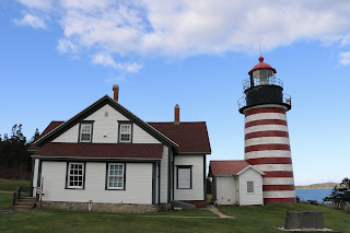

It has been lit with whale oil, lard oil, kerosene and then electricity. It is red and white candy striped - the only one in the US.
There is a porcupine in the yard and someone taking his picture says the porcupine is a regular here.
We've called a few places about camping - closed or not allowed. But one person says our best bet would be Cutler Coast Public Lands, not too far down the coast. There are two small parking areas and the only campsites are ones you hike into. We've been told we could stay in the parking area.
Greg and Gwynne decide to explore one of several trails, that leads to an Oceanview Overlook. It is longer and more difficult than expected, with mud, roots and rocks.
Nice view, steep cliffs at the end.
It turns out to be almost 3 miles and it is almost dark when they finally get back. Beth became concerned and was giving three blasts on the Trek horn every few minutes - something dredged up from scouting memories. Gwynne said she was glad to hear it, though they weren't lost.
We have hamburgers shaped to fit hot dog buns, baked beans and carrots for dinner. Quiet night.


 It is unusual in that it is marked with a large St. George's cross - hard to see from our viewpoint. It was built in 1829, one of the oldest in Canada, and guides ships entering the Passamaquoddy Bay through Head Harbor Passage. As part of the Bay of Fundy, there are large tides and the lighthouse is only accessible for four hours surrounding low tide. We didn't hit that sweet spot, so have to admire it from across the headland.


 It has been lit with whale oil, lard oil, kerosene and then electricity. It is red and white candy striped - the only one in the US.
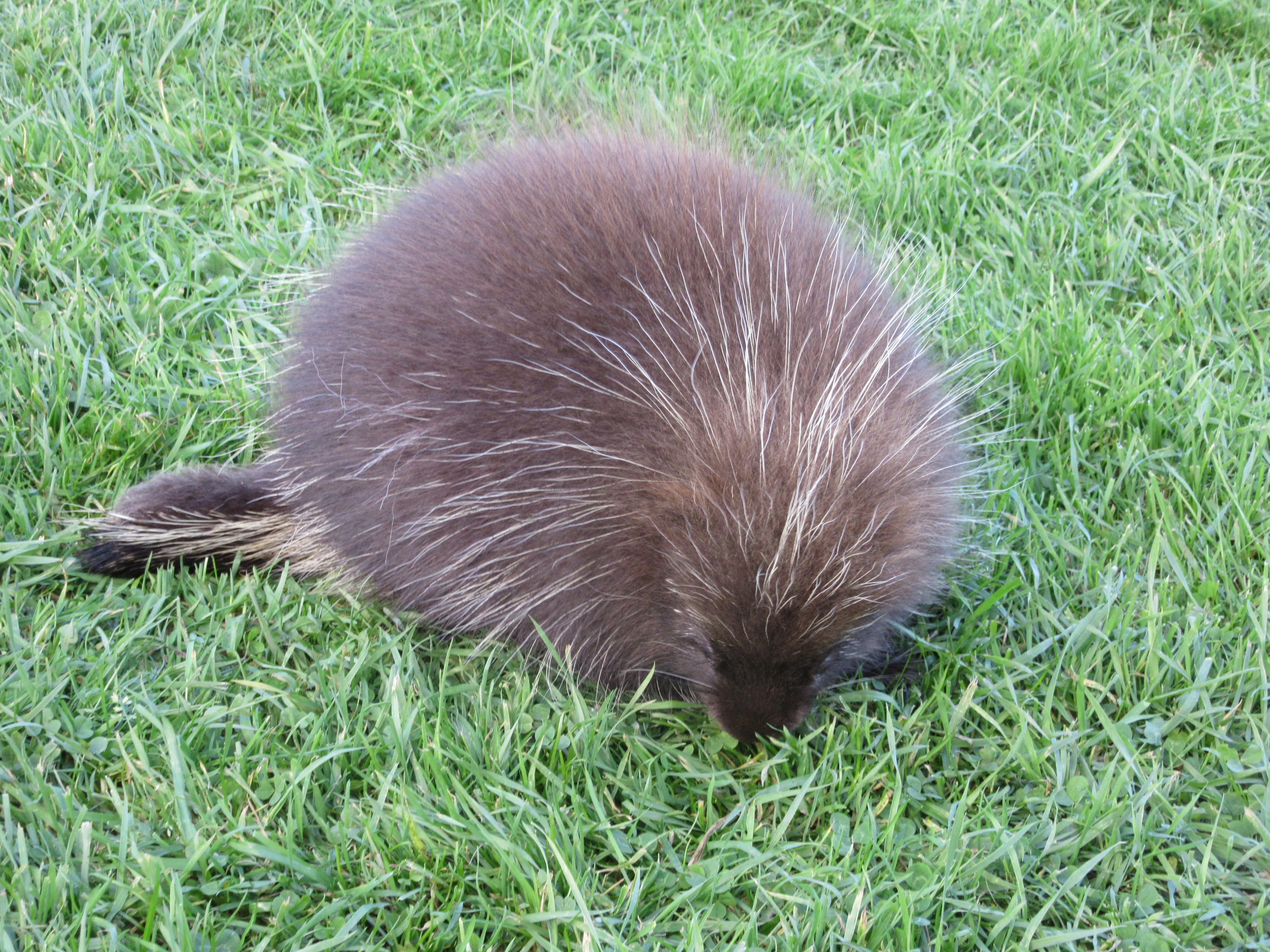


No comments:
Post a Comment