We leave Scott and Cathy's in Abingdon and get on I-95, the monster highway of the east coast. It is busy, as expected, but we aren't on it for long. After shelling out $8 to cross the Susquehanna River, we turn south on 213 and wind through the Eastern Shore. Chesapeake Bay itself is nearly 200 miles long and ranges from 2.8 miles wide to nearly 30 miles. More than 150 major rivers and streams flow into the Bay's 64,299-square-mile drainage basin, which covers parts of six states (New York, Pennsylvania, Delaware, Maryland, Virginia and West Virginia) and all of Washington DC. It is a huge part of the culture and economy of the areas it touches.
We stop by the Sassafrass River for a break and some photos. A beautiful day, cool but sunny. Many of the ports of the Eastern Shore, like Chestertown, Easton, and Centreville, date back to pre-revolutionary times. Most of these communities, we read, supported the revolution and even had their own "tea party" after Boston's. Apparently commerce was brisk, with trade from England as well as the West Indies and other parts of the world, particularly before Baltimore became a prominent port after the Revolution.


Interesting nest atop this chimney. Osprey perhaps?

Many small towns and most of the longer bridges are drawbridges. Lots of marinas and docks, large and small. The land is flat, with pastureland, tree farms, and ever-present fields of corn. And lots of water in the shape of inlets, rivers, bays and more. Famous for its crabs and other seafood, it is easy to see why!

We continue south to Blackwater National Wildlife Refuge, where we plan to spend the night. Unfortunately, part of the Refuge is closed for hunting today as they seek to thin the deer herds a bit. But Tom, at the visitor's center, points out some other interesting drives in the area and we set off. He says we can boondock in their parking lot, which is our plan, until we find out later that it isn't allowed.(Someone should tell Tom!)
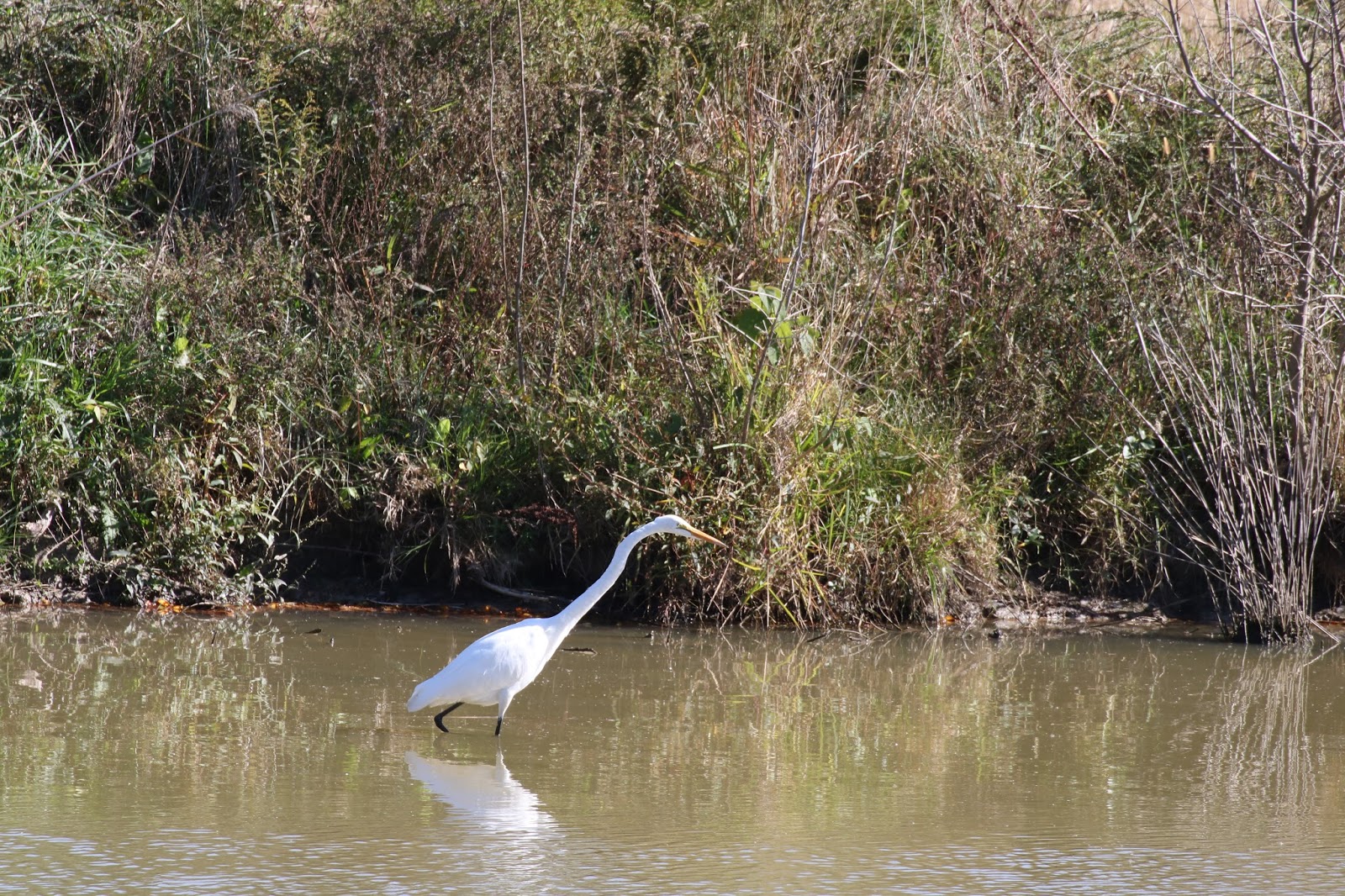
We drive several roads in and around the Refuge, spotting lots of geese, turtles, ducks, a few deer and four beautiful bald eagles. They have the most eagles of anywhere on the east coast.


We cross the Narrows Ferry Bridge and drive onto some barrier islands which take us to Hooperville and Hooper Island (settled of course by Mr. Hooper in the early 1800's). At some points there isn't a lot of island on either side of the road, but at other places there are quite a few homes, most with the water lapping at their feet. There is a mix of older, perhaps fisherman, homes and newer ones.


Near dusk we return to the Visitor's Center to boondock. It is empty except for a few service vehicles, but soon someone comes by and tells us we can't park anywhere on the Refuge, despite what Tom (a lowly volunteer) told us. This gentleman tells us of a boat launch just off of the Refuge where we should be able to stay. We drive some interesting roads and a small rickety wooden bridge getting to it, passing several folks fishing and crabbing, but find the turnout is roped off and closed. We had hoped to do more in this area tomorrow, including a nearby Harriet Tubman Underground Railroad Museum, but instead we race the sunset and head about a half hour east to the town of Salisbury and our third choice for the night - good old Walmart. Nice to have GPS to get us where we're going! We dine at a nearby Chick-fila, trying their soup and fruit salad which tastes pretty good at this point. The Walmart closes and we have a quiet evening.
No comments:
Post a Comment