Search This Blog

Friday, November 10, 2017

October 31, Povery Pt, LA and home to the Astros

October 31 Happy Halloween

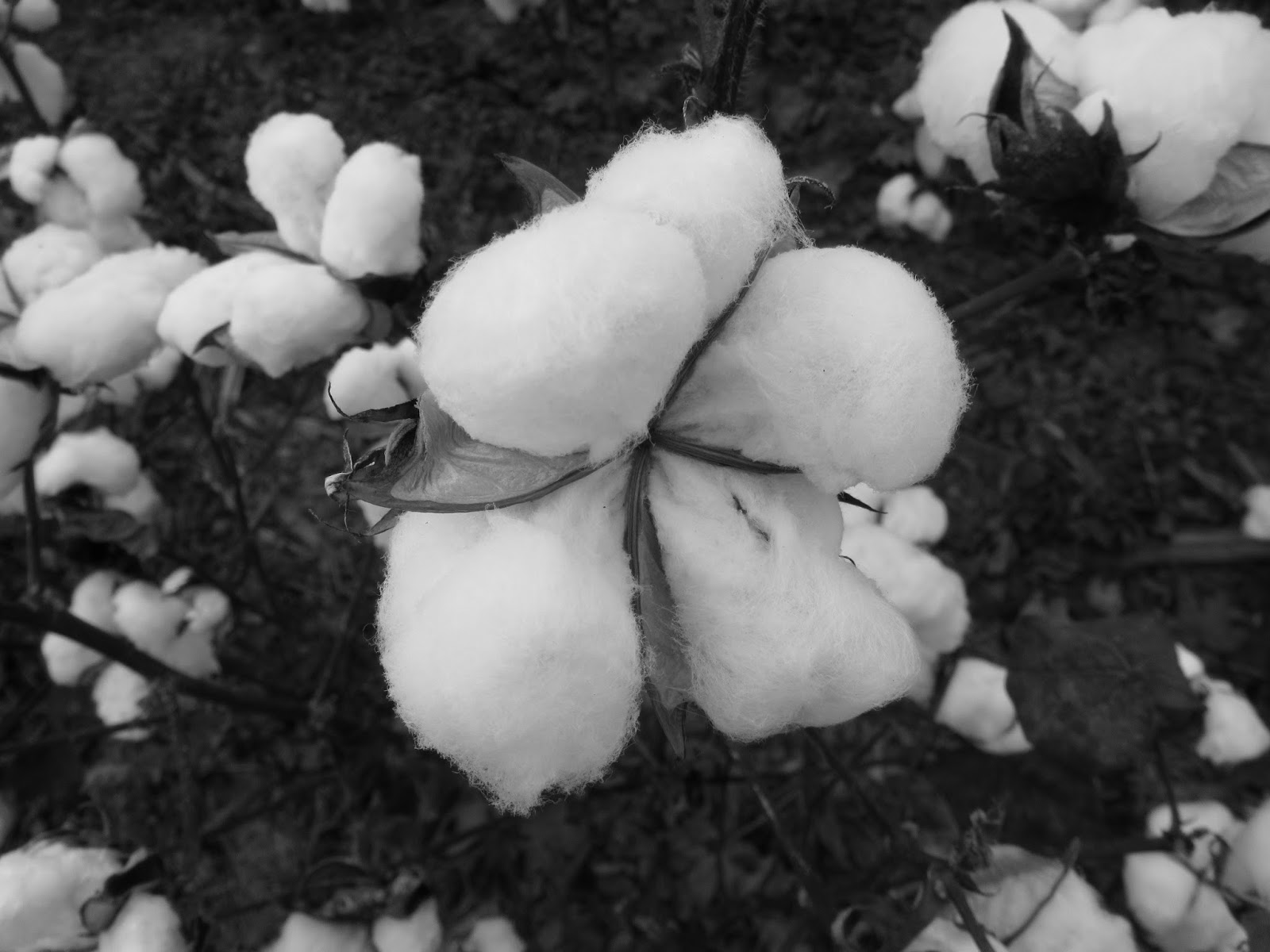
46 degrees this morning as we complete crossing Alabama and then cross Mississippi.  We continue past Natchez and Vicksburg, both nice places that we've visited previously.  We are heading for Poverty Point, Louisiana.  After a 45-minute delay due to an accident, we enter Louisiana and turn north to Poverty Point. Through lots of corn and cotton fields.  But here the cotton has been picked and made into large bales which are wrapped in plastic and awaiting pick up.  This has obviously been picked by machine, which probably most is these days.  A few waterways, but signs of irrigation too.

Poverty Point National Monument is a World Heritage Site, named after a plantation that was developed here in the 1800's.


A little less than impressive in appearance, it is nonetheless a very interesting spot.  There is a visitors center and a few other buildings and we need to head to the "Lab" to get a ranger to open the visitors center/museum.

This monument consists of 6 earthen mounds with concentric c-shaped ridges, built about 3,500 years ago by the ancestors of modern American Indians.  It is the oldest of the mound builders sites in the US.   Built between 1700 and 1100BC, it was probably the "New York City" of its day.   The earthworks were built by moving about 15 million cubic feet of dirt, probably using woven baskets.  There is some evidence of holes that may have held poles, and many of the mounds no doubt had structures of some sort on them.  The museum has displays of many decorative items, spearheads, etc. that have been recovered here.


 Where was this information in our American History books?

Evidence of some stones, copper, shells and other items indicate that these people had a wide trade network including Mexico and many neighboring states.

Mound A, the largest, was 710' in length, 660' wide and 72' above the land surface.  It has an unusual shape which some think is a bird in flight.  We walk to the top and wonder about people who walked these same grounds (minus the stairway :)) thousands of years ago!   Excavation and study continues.


After leaving Poverty Point, we discuss the rest of the trip, and decide we could head for home and make it in time to see what might be the last game of the World Series.  It will be a long haul, but we should get home just about game time - 8:00 tonight.  We hit Texas about 4:30 and make our way south and west through some rain here and there.  God bless Greg and his love of driving!

We get home in the 2nd inning and the Astros can't pull it off.  Ah well, we will be better able to stay up and enjoy the deciding game 7 tomorrow!  Yeah Astros!!
Image result for astros art

Warm Springs GA to Selma AL, October 30, 2017

October 30, Monday

We bypass Atlanta this morning, and go though lots of rolling farmland and  pine and hardwood forests.  Some lumbering going on as we see mills and laden trucks.  Lots of cattle and horses and fields evidencing Georgia red clay.  Several of the town we go through are ready for Halloween.

We decide to stop in Warm Springs to visit Roosevelt's Little White House. It is a nice complex, featuring his home, a pleasant walking area and a museum and gift shop.
 FDR came here first, following reports of therapeutic effects of the warm springs on polio victims.
This house was completed in 1932 when he was governor of New York.  It only has a few rooms - 2 bedrooms, a kitchen, a living and dining area.  He purchased and renovated a nearby resort which featured pools fed by the warm springs, and it became a place that treated polio patients. The pools are emptied right now for repairs, but we were able to stick a hand in the warm spring water.

Apparently, Roosevelt appreciated and got along well with the local people who supported him through the depression and more.  Some say he learned a great deal about the farmers and rural America here and was inspired to form the Rural Electric Administration which was responsible for getting affordable electricity to the rural areas of America.


Nearby guest house, also very simple. His family often visited, as well as some dignitaries.
Roosevelt visited here over 40 times and it was here, in April of 1945, that he died of a massive stroke.  He died while sitting for a portrait and the unfinished portrait is here in a small museum off the gift shop,
along with his specially designed car that he was able to drive and other memorabilia.


After this visit, we stopped at a Cracker Barrel for lunch, then drove to Six Mile Creek, another Corps of Engineers area near Selma, but it was closed.  Many things, we find, close in mid-October, even though our book of campsites said  this one was open year-round.  Once again, we resort to Walmart.  This one in Selma, Alabama, which was a nice one.


October 29, 2017 N Carolina/Blue Ridge Pkwy

October 29,  2017 North Carolina
We head west this morning, with the first stop in Charlotte at an LA Fitness.  Been here before and we enjoy a short workout and a long shower.  Then we head to the Blue Ridge Parkway, one of America's most scenic highways.   Some nice spots of color as we get nearer the mountains, passing through Rutherfordton where Greg's folks lived for a time.

We fill up with gas near Asheville and hop onto the southern portion of the Parkway near French Broad Overlook.  It is chilly and a little windy as we stop time and again to admire the views.


 As we climb from around 2,100' elevation to over 4,000',  the sun plays hide 'n' seek among clouds.  Still it is beautiful and we hope for clearing until we begin to notice tiny flakes of snow whirling in the wind.


The temperature has dropped to 27 degrees and just after Buck Spring Tunnel, the police have closed the road for a "Winter Storm"and everyone has to turn around.  Looking up toward Mount Pisgah (5,000'+) the trees are obviously frosted and the only color there is white!


The snow is picking up, so we decide to take a side road, route 151, which we recall passing.  What a road, as it is pretty much a series of switchbacks winding down the mountain!
 The scenery is gorgeous and colors great as Greg pretty much keeps his eyes on the road.  It is a 2 lane road, though on the switchbacks one wonders!  Fortunately we only encounter two or three other cars and the snow disappears as we descend. This pretty waterfalls is alongside the road.


The road lands us in a valley where we stop at a gas station to get further directions.  We could go southwest, though the Smoky Mountains, but suspect this winter storm is hitting there also, so we opt to go back towards Asheville and then south.  Heavy traffic when we get back on a major road, as we suspect lots of folks are doing the same.   We hit a light snow/rain mix for a while but by 4:00 we've gone through the storm and hit sunny South Carolina and 50 degrees!

We continue south and east, and find a Corps of Engineers campground near Hartwell Lake just over the Georgia border - Georgia River Recreation area. The campground is closed, but there are restrooms and other parking areas, so we find a likely spot and stop.
 We go for a walk and see only one other car.  We are just below a dam and the water in the river is very low with lots of visible rocks.  There are signs that say a siren will sound when water is to be released, so that fishermen and others can get off the rocks.


Three times during the night, the siren sounds.  Not really too loud, but we definitely hear it, and in the morning, those rocks are all underwater!  Greg estimates about a 3' rise in water level - that's a lot of water!

Tomorrow we will head to Athens via back roads and drop down to avoid going through Atlanta.


Thursday, November 9, 2017

Oct 28. Virginia/Chincoteague/Asateague

Saturday, October 28

49 degrees this morning as we leave Salisbury and head east into Virginia.  We pass Wallups Island which has a very large NASA facility. Lots of satellite dishes and other equipment behind security fences.

We cross the bridge to Chincoteague Island and stop to walk the Marsh Trail.  Lots of birds and signs that the ponies have been this way,  The grasses are golden and graceful in the light winds. Quite a few birds in the trees along the trail.


Lots and lots of grasses which provide food for many animals.


We cross to Assateague Island and stop to walk the trail to the lighthouse.  There are quite a few boy scouts visiting but we manage to fit in between two groups.

 The lighthouse was first built in 1833 but wasn't very tall.  It was rebuilt in 1866 and remains one of 20 still functioning along the Atlantic Coast.  Nice views from the top.


We drive some more and stop to watch about ten grazing ponies.  We've read about and seen the ponies before, so just admire them and move on.


 They are very pretty but very careful to keep their distance from the gawking visitors. Lots of egrets and other shore birds in the area.


We stop by the Visitor's Center and browse their displays.  Not a lot scheduled for this weekend as they are pretty busy with the Boy Scout gathering and the season is technically over.  A few folks walk the nearby beach.

  It is close to lunchtime, so we drive back to the town of Chincoteague and stop at Don's Seafood for some shrimp and soft-shell crabs. Their own nice light breading on fresh seafood!

 Served with hush puppies and tasty tartar sauce.  Delish!

We head back to the mainland and south to the Chesapeake Bay Bridge-Tunnel!  Quite a marvel to me!  It is a 23 mile fixed link at the mouth of the Chesapeake Bay, composed of a combination of bridges and tunnels which cross the Bay to Virginia Beach.


According to our GPS, it saves about 5 hours of travel time vs traveling back to Baltimore and south through Washington. I suppose that IS worth the hefty $13 toll.  Built in 1964, and upgraded,  it replaced a ferry.

We continue south on I95 into North Carolina and acres and acres of cotton fields.


  Now we have a decision to make.  To keep heading south with stops along the coast - Myrtle Beach and more,  or begin to turn west and take in the Blue Ridge Parkway.   The Parkway wins, and we turn west, spending the night in Zebulon, NC, a suburb of the Raleigh/Durham metroplex.  Pleasant, quiet evening at our friend Wally's after a good salad at Applebees.