We continue along the northern coast of Michigan, with lovely views of the lake from time to time.

Wooded countryside with lots of acreage for sale. Several home-made signs "2,282 acers" or "350 acers" for sale. They are probably better with numbers.
We come to Grand Marais and pass by the Pickle Barrel Museum, which isn't open yet (oh darn).


 |
| What a jig-saw puzzle this would be! |

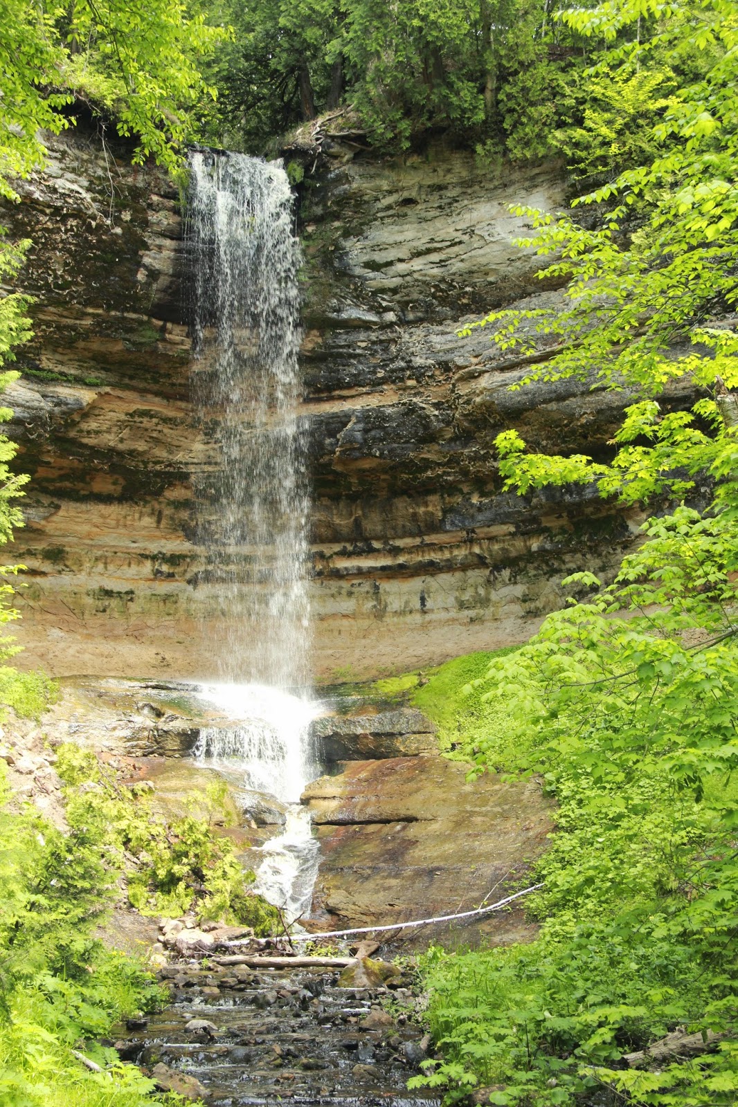
Next adventure is Pictured Rocks National Lakeshore - one of four such designated areas. We stop at the visitor's center and are directed to a few of the park's highlights. First is Sable Falls, a pretty falls with a short trail.

Next is Log Slide Overlook. In the late 1800's there was lots of logging of red pine and white cedar in this area. This site on the dunes is where the logs were slid down to the lake where they were bundled into rafts and transported.

The Au Sable Light Station Trail was recommended, so that is our next walk, about 3 1/2 miles. At the trailhead there is a stream in which we see Coast Brook Trout, called adfluvial, which live part of their life in the lake and then travel upstream, a la salmon, to spawn. These seem to be resting and steeling themselves for the fast water ahead. They are about 18"-24" long.
 |
| downstream, the fish come from the lake |


 |
| upstream, where the fish are headed |
The trail is through woodlands and we see some unusual flowers,


The trail leads to yet another lighthouse, Au Sable (French for "with sand") Light Station.


Spring has just arrived here as lilacs and butterflies attest.

 |
| lady's slipper (the Minnesota State Flower) |
 |
| Apple Blossom, the Michigan State Flower |
Next stop is Miner's Castle Overlook where we can get a peak at the famous Pictured Rock cliffs which (we have been told AFTER coming here) are best seen by boat from Munising for a mere $36 each. Or from 10 mile + trails. Miner's Castle is 75' high and some of the cliffs we are told are up to 200' above the lake and very colorful.

We stop at Munising Falls
and the Northern Beach of Sandy Point and see the Picture Rocks in the distance.

There is a beautiful field of lilies of the valley here which easily wins the Scratch 'n' Sniff of the Day.

We head onto the city of Marquette and stay at a Lowe's, doing some cleanup and getting a good night's rest.
This day was my favorite so far, I think! From rippling water to picture-pretty pebbles. What a beautiful area of the country!
ReplyDeleteKathy