The valley of the Rio Urubamba river, also called The Sacred Valley, about 15km from Cuzco, is today's destination. Our driver today is Filipe, and our guide is Gladys. On the way out of town, Gladys points out people selling large bags of greens - this is alfalfa, which is food for guinea pigs. Many families keep pens with 20-40 guinea pigs which are used for food. Generally they are used for special occasions.


Much of the valley is used for agriculture - wheat, barley, oats were planted before the rainy season and are now ready to be harvested. A great deal of corn is grown too. Eucalyptus trees provide wood for building and firewood. Generally, horses and people are used to plow, plant, and harvest the mostly smaller plots.

First stop is the town of Chinchera, known to the Incas as the birthplace of the rainbow. A weaving center, we visit a shop to see demonstrations and product. It is obviously set up for tour groups, but interesting nonetheless. They show us how alpaca wool is washed and then colored using different plants. Wool from baby alpacas is the finest and softest.


Lots of products for sale - blankets, bags, hats, scarves, sweaters, etc.

Nearby there are several alpacas, vicunas and llamas on display.
Back on the road, Gladys informs Greg and I that we need to pay 70sol each for tour tickets, and our 55sol lunch is also not paid. We hadn't been told this by Exotica, and itinerary includes the tour, but Gladys says they contacted them and were told it wasn't covered. Thankfully we have enough money to pay it and we'll deal with Exotica later....
We head into the mountains next, to the town of Moray. The buildings here are adobe. We walk to the archeological site where the Incas used deep spiral terraces to grow crops.

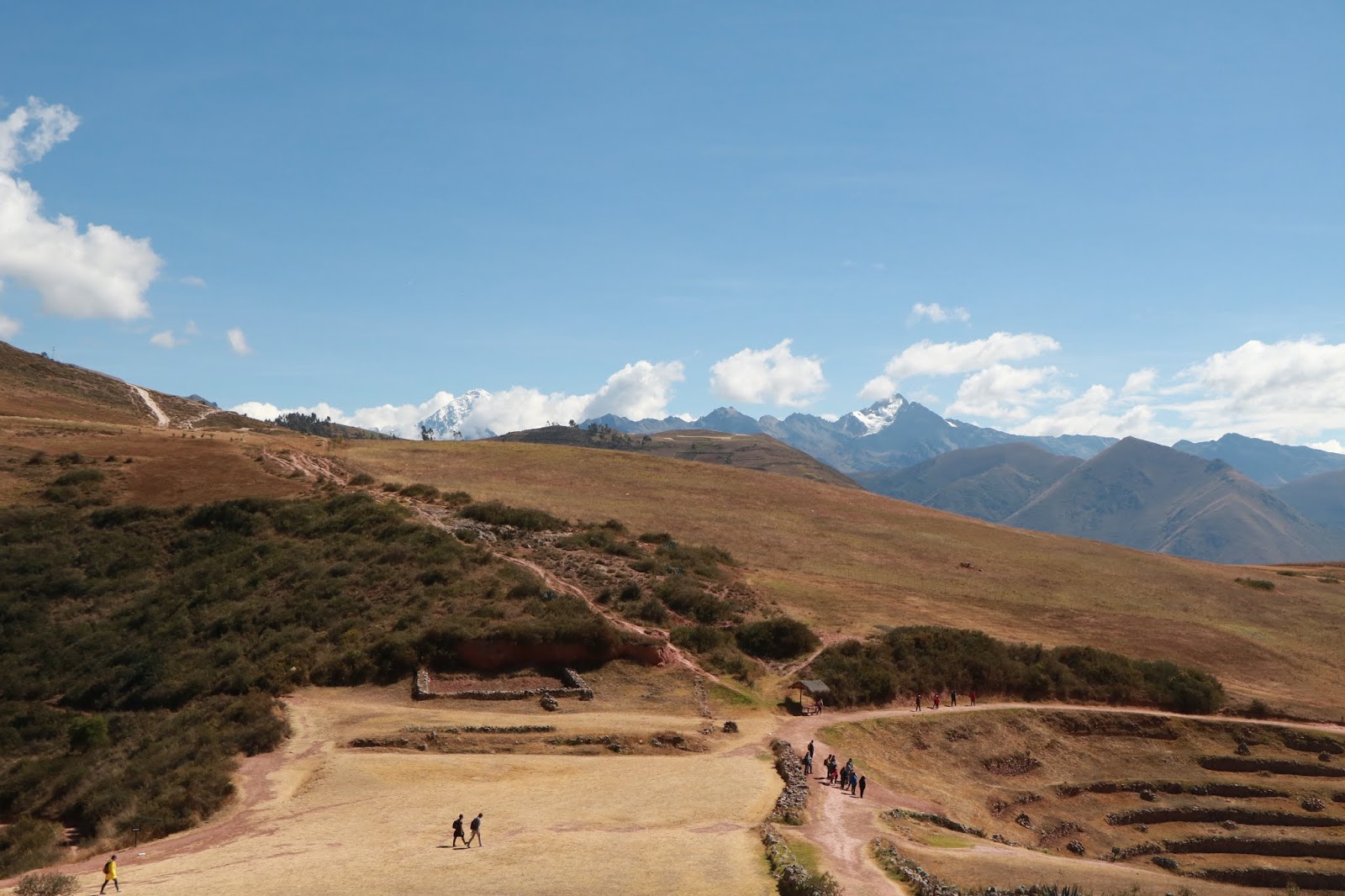

Leaving Moray, we pass people harvesting potatoes by hand


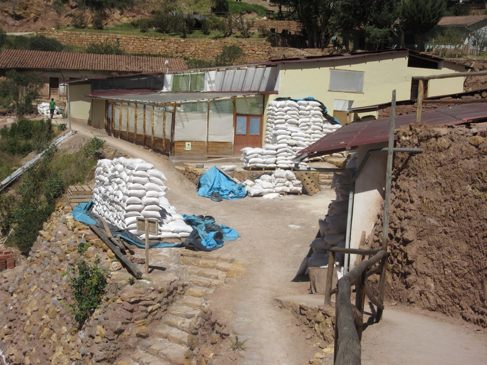
Next stop is Salinas, home of the salt mines.


The top layer of salt is white, the second layer is pink(ish). Of course there are bags for sale here, but much bigger bags are ready to be shipped as well. They ship 400-600 tons a year!

The roads away from the salt mines are very narrow dirt roads. At some spots there is only room for one vehicle, so we (or the other vehicle) have to back up to a wider spot to allow traffic to continue.

From here we head to Don Angel Inca Casona Restaurant for a large buffet. A man plays flute while we eat.


We continue to follow the Urubamba river, which keeps the valleys green. At some places there is rafting on the river at certain times of year. Apples, avocados and some other fruits grow too.


We go next to Ollantaytambo, which means "resting place". The streets here are rough stone. We park and walk to the archeological site. This is the best surviving example of Inca city planning and the town has been continuously inhabited since the 13th century. Some of the original Inca houses are still in use.


They dried a lot of foods to store them - dehydrated potatoes, for example can be stored up to 50 years!

It has become very windy and temperature is falling as we walk through the market and back to our van. We are all staying at the same small hotel tonight in Urubamba, a fairly utilitarian town and transportation hub. The part that our hotel is in seems to be many car repair, gas stations, banks and restaurants, though our hotel is quite nice.


Town is small, with a mix of businesses and homes. Sidewalks are irregular and sometimes non-existent. Early wakeup call tomorrow at 4:30, as we need to take a train and then a bus to reach Machu Picchu!
No comments:
Post a Comment