9/19/21
A mild 48 degrees this morning. We enjoyed some breakfast tacos, then drove on to complete the rest of Kebler pass. It rained during the night and we had drifting low clouds early.


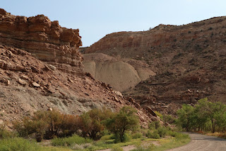
As we continue along Hwy 70, there are rugged looking low mountains paralleling us to the left, behind scraggly, semi-desert terrain. We decide to go see what is beyond the rocky hills and turn at a sign pointing to Escalante Canyon.
The well-maintained gravel road twists into rugged rocky hills, over railroad tracks and a slow moving stream, and eventually into the Canyon.


See the little blue dot in this picture? It is a small teardrop camper! Now that is really boondocking!


We stop and pick up a few rocks, then get back onto 70, wondering how many other hidden jewels we are passing by... We stop for gas at Grand Junction, grab a Subway sandwich, and head into nearby Colorado National Monument.

We get a map and a chat at the OPEN visitor's center and then go to nearby Saddlehorn Campground and grab a spot for this evening. It is FCFS - first come first served - and we get one of just a few available sites. The camp host says there is a biking event tomorrow so they are busier than usual.
Then we set out to explore the 23-mile long Rim Rock Drive, which has many pullouts for picnics and photo ops. The Monument rises 2,000' above the Grand Valley of the Colorado River at the edge of the Uncompahgre Uplift, lifted by the same forces that formed the Rockies. It is semi-desert, with lots of pinyon pines, Utah junipers and sagebrush.

Through a few tunnels on the way to the top.
This is balanced rock.

The green of the trees and red of the rocks are an amazing duo, and the clouds reveal patches of brilliant blue on and off. Wow!

Quite a view from the top.

This is Independence rock, which is 450' high, and yes it has been climbed. A friendly woman takes this pic for us.


Just beautiful! We end at Cold Shivers Point, and then go back to our campsite.
It is kind of warm, so we decide on an easy dinner of tuna salad with crackers with our delicious Colorado peaches for dessert. Glad we have a fridge.
From our site, we hike the Window Trail to try to catch an interesting sunset, but clouds obscure most of it. Still, a nice seat by a rocky cliff, with a fantastic view and cool breeze is a pleasant way to spend some time. We sat on a ledge to the right of this tree.

The moon is full and very bright, overpowering most of the stars. We try a few night shots, but without great success. I am reading a book titled Indian Killer: A Novel, somewhat disturbing but nonetheless intriguing novel. Greg is finishing Complications.

No comments:
Post a Comment