38 degrees this morning, brrrr! After breakfast we go back past all the tailings, to 75N and continue along the Salmon River.
The road eventually leaves the heavy forest and winds through more rocky terrain mixed with sagebrush and some grasses.


We got a smile from this roadside airplane "crash".
Near the town of Clayton (population 7), we come across this site that was used as a Buffalo Jump. Settlers arrived in this area around 1860, but before that there were many buffalo. Native Americans sometimes stampeded buffalo off of a cliff - we've seen this in other places in Montana and British Columbia.

There are many signs to watch for bighorn sheep on the roads, but we haven't seen any.
We drive into the town of Salmon and to the Sacajawea Interpretive, Cultural & Educational Center, which is open.

Two ladies outside the center talk about flowers and birds of the area. They suggest we walk the trail, about a mile long, around the center before watching a film and checking out the displays.
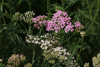
This is yarrow. We've seen the white all over the place, but never saw pink before!
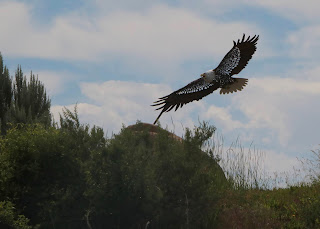
A nice milelong walk, with various displays in a natural landscape. This eagle sculpture was terrific, and there were fish along a small stream.
The Native Americans who lived in this area were called the Agaidika Shoshone. Agaidika means "salmon eaters" and salmon was a major part of their food source. This area, nearly 800 miles from the Pacific, is one of the furthermost reaches of the salmon migration.
 Native Americans often used a fishing weir similar to this one to catch fish.
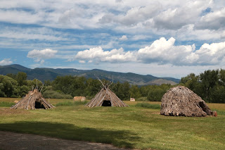
 And they lived in a gah tine, tipi, made from pine poles covered with buffalo hides (aka canvas),
or in summer in a sihuvee gahni - brush lodge.
They were expert horsemen and breeders of horses decended from those brought to the southwest by the Spanish.


We then went inside and watched a short film about the Lewis and Clark expedition and Sacajawea's role.
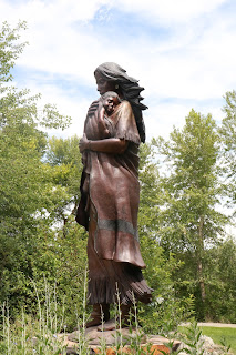
 Sacajawea was an Agaidika Shoshone. However, she was abducted by another tribe when she was 12 or 13, and grew up in North Dakota with the Hidatsa tribe. She was traded to a Canadian fur trader named Toussaint Charbonneau and gave birth to a son shortly before meeting Lewis and Clark. She was invited to join the expedition as a Shoshone interpreter and one of her first jobs was to aid in negotiations to purchase horses so that the expedition could continue. One of the Shoshone they negotiated with turned out to be her brother whom she hadn't seen since her abduction!
 She was also an asset to the expedition in finding edible and medicinal plants and in other practical ways. She was also a symbol of peace since traveling with a woman and child made the group less likely to be considered a danger.
The displays were nice, but left you wanting more.
I read
the book,
Sacajawea by Anna Lee Waldo many years ago and really enjoyed it. I think I kept it, so will see about re-reading!
From here we decided to go south and explore the 39 mile Lewis & Clark Back Country Byway, a dirt road which was occasionally challenging. It climbed into the mountains to the Continental Divide and Lemhi Pass where the US flag was unfurled and where Lewis, scouting ahead, first set eyes on the immense Rocky Mountain range. There is a disclaimer at the beginning of the road, warning about the road.
Imagine traveling this land on foot! And when you reach the highest spot you look west and see more snow-covered mountains to be crossed.
Parts of the drive were very pretty - like these yellow and blue flowers under the evergreens. But overall it was underwhelming. Historic maybe if you are really into Lewis and Clark.

.
We hit the paved road again and continue north, passing the 45th parallel. It seemed like every 20 miles or so there was a "historical marker" that had something to do with Lewis & Clark. We remember seeing the same thing along the Columbia River in Washington. Kind of a western version of "George Washington Slept Here".

We don't see much in the way of campgrounds or boon docking spots. Finally, near Gibbonsville, we take a left on Granite Mountain Road into the National Forest.
It turns out to be mainly an empty logging road but we find a turn around area that will suffice. The only people we see are two ATV'ers. We hear some fireworks and a bit of rain, and bring out the cribbage board (Greg kills me),
and sleep well after a dinner of ham, yams and fruit salad.


No comments:
Post a Comment