Search This Blog

Monday, November 14, 2016

November 5, Long Road Home

Saturday, November 5

 Greg decides we might as well hit the road as we both wake early this morning.  It is 66 degrees at 7:00 and the temperature drops to 57 as we head north, through a border patrol checkpoint, then back to Marathon for gas and onward to I-10, the major east-west road in these parts.

We go through some light rain and it remains cloudy all the way to Houston.  
We stop at a rest stop where the remains of the Tunis Creek Stagecoach Stop make an interesting diversion.
 We were going to stop at Junction, which has a nice free camping area in a city park by the Llano River.  But it is only 2:00 and Greg says we might as well push for home.  Traffic gets heavy and slow as we take the loop around the north side of San Antonio.  Every hotel and store you can think of in this 18 mile stretch.

Back on I-10, we head for Houston.  I note all the tire debris along this road and for grins see how much appears in one mile.  I checked 6 or 7 miles and found 7-9 larger pieces per mile, mostly on the shoulder.  Yes, we are still smarting from the earlier damages....

We arrive home just after 7:00.  Chap has been here for a few days and we spend a while visiting and catching up with him.  Unfortunately he isn't feeling very well and turns in early.  We do some basic unpacking but leave most till tomorrow.  

Travel is great, but there's no place like home, Dorothy!


Friday, Nov 4 Big Bend

Friday, November 4

Got up early and drove down to Santa Elena Canyon for sunrise.  Had to drive through some water and mud on the road due to last night's storms.  The sunrise never really materialized due to cloud cover.
 So we ate some breakfast and went back to the campsite briefly, then headed north again.

Stopped at the Mule Ears Trail at 9 AM.  It is 73 degrees and pretty comfortable with cloud cover.
This trail goes through hilly, rather rocky desert terrain.  You can see the mule ears in the distance.
 This pencil-thin cactus was full of red fruits - haven't seen this before!
We spotted this big jack rabbit in some brush near the trail and saw several lizards and beetles skittering away.


We go by a rock corral and end at the small Mule Ears Spring, surrounded by rocks, trees, reeds and these lovely flowers.


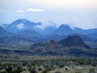
We arrive back at the Trek about 11:30 and the temperature has dropped a little.  There are still low clouds in the mountains as we pass by further north.
 We continue down towards Rio Grande Village at the east end of the park, with a couple of stops to check out some tarantulas crossing the road! They are about 4-5"wide.

That's Beth way back there tracking a tarantula
Rio Grande Village Campground is sparsely populated so we find a nice campsite (#18) which is roomy and mostly surrounded by trees and bushes.
 The nearby store/gas station/post office/showers/laundramat beckons and we get some cold drinks to go with our sandwiches, eating outside at their picnic tables where we can get some wi-fi.    Gas is $2.71 out here but thankfully we don't need any.

From the campground we follow the River Trail to the Rio Grande River.  The river is much wider and faster than we've ever seen.


After the hike, we go back to the store for nice hot showers - $2.00 for 5 minutes feels like a great bargain to us!

We relax at the campsite for a while and this roadrunner passes by in a hurry. Roadrunners can fly, but often outrun any dangers, beep beep!

Nearby I see another new bush - this an evergreen with pretty red seeds popping out of golden "husks"(?).

We head up the nature trail to an overlook for sunset.  A dozen or so people have gathered as the sun illuminates the cloud-capped, pink Santa Elena Mountains.

Back at the campsite we try a few star photos, but it is too cloudy again.  I do see a beautiful, long, streaking, shooting star which is cool.  I have a great video of it in my mind!

Cheese and crackers and then a hearty chicken rice soup from home.  We edit today's photos and do some reading before calling it a night.


Sunday, November 13, 2016

Nov 3 Big Bend

Thursday, November 3

It is 62 degrees this morning. We decide to drive up to the lodge/store and do the Basin Loop Trail which begins near the store.  We check out the store and buy some jelly for PB&J - which I forgot to pack.

The fog is rolling and blowing over the mountains the morning light, though it doesn't reach down into the basin.


Despite the lion and bear warning signs, the only wildlife we see are these deer having their breakfast.

 The trail climbs for a while, giving us nice views, like this one of the top of the lodge,
then levels off.  When we turn and begin to descend, the morning light falls beautifully
on the scene,  giving the rocks a golden glow.  From here we can see the v-shaped "window".  At certain times of the year the sun sets through the window, but not in the Fall.


We see a lot of birds flitting in the brush/trees.  Quite a flock of noisy blue ones, I think Mountain Jays.

On our way out we stop by the lodge.  No cell service still, but you can get wi-fi in the gift shop, so we send a few messages and then leave the Chisos, heading for Cottonwood and the Rio Grande.
Low clouds continue to flow over the mountains, sometimes dipping into chasms and canyons.

The road to Cottonwood is scenic.  We have done most of the trails along here, except for the Mule Ears Trail which we will get to later.  We decide to get a campsite first and arrive there about 1:45.  It is 90 degrees down here (Chisos is always about 10 degrees cooler.)   Only one other camper, so we get a nice site under some big cottonwood trees.
 They irrigate the campground from the nearby river, so it is nice and grassy.

We drive a short way to the Dorgan-Sublett Trail which visits the sites of some early settlers' homes.  This area was farmed in the early 1900's, using water from the river for irrigation to produce cotton, sorghum, wheat and melons.  Once abandoned, around 1938, the juniper, mesquite, grasses and cacti soon reclaimed the land.   I call this our "R" trail, as we see a Roadrunner, a couple of Rabbits, lots of Rocks and several Ruins of stone and adobe buildings.


Next we stop by the River take-out area where a guy from Desert Sports of Terlingua is waiting for canoers to arrive.  Depending on water levels, they run canoe and raft trips.  The water now is exceptionally high due to rains upriver.  When talking about rivers and Big Bend, it will always refer to the Rio Grande, which forms the southern border of the park and also the border between the US and Mexico.  (Would hate to see Trump's wall mar this landscape, though it probably wouldn't be too difficult to cross.)  We see an occasional border patrol vehicle but not often.

Back at the campsite, the wind has picked up considerably but Greg manages to cook some hamburgers on the grill.  Several other campers have arrived, mostly tenters. One is a tracker here for an event tomorrow tracking and observing wildlife, another group are getting ready for a river trip.

As darkness falls we can see some flashes of lightning to our southwest.  The storm approaches and we have some torrential rains, lightning, thunder - the works! later on.  So glad we are not in a tent, as I think some of them ended up in their vehicles.  We had seen great horned owls and javelina here before, but nothing this time....maybe due to the weather.

We set an alarm to get up early in order to drive to Santa Elena Canyon for sunrise.


Wed, Nov 2 Big Bend

Wednesday, November 2

This morning we are off to Big Bend National Park.  We take 54S and leave the Guadalupe Mountains in the rearview mirror.  Mostly flat land again till we reach Van Horn.  A popular spot for travelers on I-10, we take advantage and fill up with gas, propane and a few groceries. We head east on I-10 briefly, then turn south through the Davis Mountains and Fort Davis.
 Pretty countryside. We pass this odd building - smallest Target store ever??
We can see the McDonald Observatory atop the mountains.  One day we would like to attend one of their "Star Parties", but with the clouds this isn't the time....

Another cool courthouse in Fort Davis.

We continue south, then east to Marathon to top off with gas.  We reach the entrance to Big Bend about 2:00 and learn that the Lost Mine Trail, which we'd hoped to hike, is closed due to bear activity, as are some of the back country trails. But there are plenty of others.

There are three campgrounds in Big Bend.  The Chisos Basin is nestled in the Chisos Mountains, the Rio Grande Village,  largest,  is lower down by the river and has a few sites with electricity. Cottonwood is small and near Santa Elena Canyon to the west.  We plan to hit all three but head first to the Chisos which is fairly small and always seems to fill first.

The road in is spectacular as it winds into the mountains, then drops to the campground - the name Basin is very apt. Vehicles over 24' are not allowed due to the steep and windy road.


You can see the campground faintly in this photo - the bits of white surrounded by mountains.

We find a good spot, set-up and then head out for a walk.
We start on the Window Trail but know we won't have time to complete it, so branch off and stay local. Spot this recently deceased lizard near the group campground - about10" long. We've never seen one this big!
Also spot this colorful fellow (grasshopper?) on the trail.
  We wash hair and clean up a bit before meeting our new neighbor - a tall young woman from Pennsylvania who we had seen in Guadalupe.  She worked up in the Texas Panhandle for the Summer building trails at Lake Meredith and is doing some site seeing on her way home. Tenting.

There is a lodge up the hill where we have eaten a time or two in the past.  They have also built some rental places.  Reservations need to be made far ahead. No signal here, though there is a land line apparently. Cell service?  What's that?

Cloudy, cool evening with pleasant breezes.

 Reading, photos, chat.  Greg is reading a huge volume about Harry Truman.  I am reading Rough Trip through Yellowstone about a Winter exploration of the park back in 1894. It is part of the suggested reading prior to our trip there in January.


 Sunset tints the clouds briefly, then all is quiet.


Friday, November 11, 2016

Tuesday, Nov 1 Guadalupe Mts

Tuesday, November 1

64 degrees this morning.  Beautiful sunrise as we head out to the McKittrick Canyon trailhead, a few miles' drive.
 We see several deer along the way.

This will be about a 7 mile hike and we sign in on a register at the trailhead.  It begins going through desert and turns more green as we head into McKittrick Canyon. Though we are the first to hit the trail this morning, we will be passed by a few folks within an hour or so.  At one point we find a lady from Ontario, who passed us, paused on the trail watching a pair of deer groom each other.  As we join her, another couple from Texas comes along.  The deer seem fairly used to people and we all move on, letting them continue their morning ablutions.


 Lots of agave along this trail, from tiny fist-sized plants to some nearly four feet in diameter and three feet tall. Known mostly for use in production of tequila,  the sap is also used as a sweetener.  The leaves' fiber is also used in making twine.


The elevation rises, but rather gently, as we stay near the bottom of the long canyon. Gradually we begin to see maple trees which are changing color.  This is about as much "Fall Color" as you will see in Texas!


We leave the main trail to reach "The Grotto" - a cave with many chunky stalagmites and stalactites. There are some picnic tables nearby so we stop for a drink and snack.
From the grotto we take a short trail to an old abandoned stone line cabin.  There is some water with reeds nearby and there are several muledeer enjoying this spot.


The main trail continues on for miles into the mountains, but we decide to turn around here.


On the return we stop by the nearby Pratt "Lodge", built back in the early 1930's by Wallace Pratt, an oilman who fell in love with this area.  He purchased other land and eventually donated the buildings plus 5,000 + acres to the National Park Service, which became the basis of Guadalupe Mountains National Park.  Interesting that the two buildings there have flagstone covered roofs - probably well insulated! A few other hikers are resting here on the front porch, so we stop and chat for a while.  They are from Philadelphia, Missouri  and New York.  There used to be a pool near here, but from what we can see the "river" that ran here is mostly gone - at least at this time of year.  Still, you know there is water available because of the trees and grasses.


I love this photo Greg took.

Though this was a longer hike, it was much easier than the Devil's Hall. We were thankful that it was a cloudy day, with some breezes so temperatures stayed comfortable!

We returned to our campsite for some R&R!  Greg chatted with a neighbor who was traveling to every state's highest point. A retired social studies teacher from Minnesota, he has been to 46 of the spots, some of which, he says, only members of the Hightoppers Club go to because they are otherwise so insignificant. Guadalupe peak, the highest point in Texas, is nearby.

We also chat with a woman who is traveling from Colorado to Spring, Texas for a wedding!  Her husband didn't want to come, so she is on her own.  She fills us in on some of her favorite spots in Colorado.  She is familiar with Spring as she taught in Houston for a few years and now has a son living there.

No sky picture opportunities, as it is pretty cloudy again tonight.