Search This Blog

Friday, October 16, 2020

October 3, Dry, Bridal and Whitewater Falls NC

Saturday, October 3


38 degrees this morning, so coffee and hot chocolate are first priority!   We head out early and stop for a few photos of the fog coming off the water.  This was at Avery Creek Boat Access area. 


 And then Blue Hole.  A very quiet and peaceful look.


When we reach a town, we stop for a breakfast sandwich and more coffee from McDonalds.  We check email, get gas, and Greg buys a North Carolina map.  REALLY need it, as these winding, twisty roads have done a number on my usually-pretty-good sense of direction.  Within 3 minutes, we are heading north, then east, then southwest, then north again, then west, etc.….Yikes!  Even GPS gets confused sometimes!
 
  We go through  Stegoah Gap where the Appalachian trail crosses the road - or maybe the road crosses the Appalachian Trail. And along more rocky streams.


Fog lingers most of the morning and we arrive at the first waterfalls around 11:00.  (Today's Lesson:  what looks like 50 miles on the map ends up being well over 100 actual SLOW driving miles!) 

 Dry Falls is anything but!  The smallish parking area is full so we have to wait a few minutes for a parking spot!  $3 usage fee but the bin to deposit the fee is so full it is just as easy to remove money as deposit it.  Most everyone is wearing masks and being aware of spacing.  The Falls are beautiful and there is a nice trail which winds behind the falling water.  If you look closely at the second and third photos you can see some people.


A few miles further down the road is Bridal Falls.  Less spectacular, but still pretty.  The old road used to go behind the falls, but it is closed now.


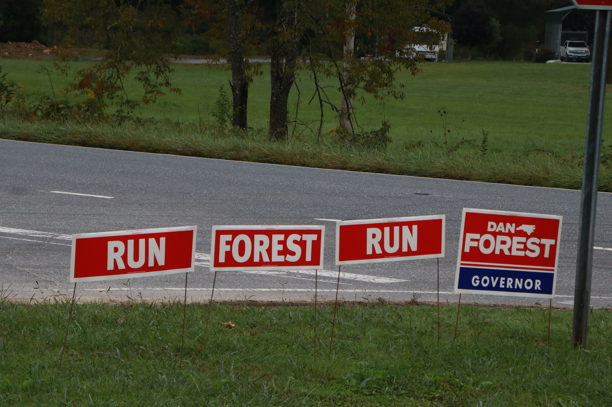
We are traveling through mainly rural areas, farms and small towns amid the forests.  Lots of Trump signs and we got a kick out of the signs for a man named Dan Forest who is running for governor….shades of Forest Gump!


On our way to Whitewater Falls we dip into South Carolina for about two minutes, then back to North.  Duke Energy is very big in this area and we take a little side detour to a Duke Energy Scenic Overlook.


Whitewater Falls is one of the largest in the US east of the Mississippi.  It falls 411 feet.  We hike down to the Lower Falls Observation area, including 154 stairs, and follow the Foothill trail.  This one is a beauty!


I love how as you walk along you begin to hear the Falls long before you see them.


No idea what this pretty blossom along the trail is called.  Anyone know?

Thinking of where we’ll stay tonight, we try two nearby State Parks (by phone) but both are filled.  So, we take a road that appears (on the map) to go into a national forest, thinking we could do dispersed camping there.  Lots of private property instead,  but we finally come to Wolf Creek Lake Boat Access area, just past a dam.  Looks good to us!  The parking area is kind of tucked into a wooded area so though we are fairly close to the road we aren't really visible from the road.


There is one boat trailer there but the boat soon is loaded and they are gone by 6PM.   Chili from home tonight, which tastes good on a cold, quiet evening.


Oct 2, TN to NC - Cherohala Skyway

 Friday, October 2

48 degrees this morning, so we fire up the hot chocolate and coffee first thing.  A short walk and then we enjoy some breakfast tacos before leaving Rhea Springs.  

 We are off the highways now, heading into the mountains and hills of southeast Tennessee.  Greg says it is time to throttle back and slow down and enjoy the ride.  We wind in and out, up and down the mountains to Tellico Plains, TN where we pick up the Cherohala Skyway, a sinuous mountain road that is a favorite of motorcyclists and sports car enthusiasts. Some brave cyclists, as well.


 What a beautiful day and beautiful drive – though Greg had his eyes on the road much of the time, handling those S curves, switchbacks, blind curves and steep grades - slowing down isn't an issue!  The name of the highway comes from the two National Forests it goes through – the Cherokee and the Nantahala. 

And we are into the land of Kudzu, that crazy creeping vine that is taking over parts of the south!


We take a side road with a sign that points to Bald River Falls – waterfalls are one of the things we are looking for.  The road follows a  swift-flowing, rocky river for several miles and we stop now and then to get a closer look. The sounds and smells are terrific.


 These guys were just beginning a whitewater canoe and kayak jaunt, so we watched for a while.


And here is Bald River Waterfalls.  A dozen or so people, wearing masks and keeping their distance we are happy to see.


Then back to the Cherohala and higher elevations.


Except for the Amazon,  the Southern Appalachian Mountains represent the richest and most biological diverse ecosystem on earth!  Who knew?  But it hasn’t been without problems as commercial logging in the early 1900s nearly wiped out the forests. In 1911 President Taft signed the Weeks Act, which authorized government acquisition of private lands in much of the eastern US to protect forests and watersheds.


We pass through the Tellico Bear Reserve, 28,000 acres meant to protect black bears. Each bear can travel a 25 square mile territory and a healthy bear population is indicative of a healthy forest.   Hoping to spot one (from the car), but no luck.  Still a few summer flowers hanging on...


We cross into North Carolina and stop at Whigg Cove for a picnic lunch at 4570 ‘ elevation.  A short while later we  stretch our legs on the Huckleberry Trail, which is at 5300’. 


 Lots of “Balds”, “Gaps” and “Knobs” in this area – rocky bald spots in the forested  mountains, low areas between mountains, and tall rounded knobs above the trees.  This is the view from Haw Knob.


The mountains go on and on. 

At the end of the Cherohala Skyway we find a campsite at Horse Cove National Forest Campground, near the Joyce Kilmer Forest.  "I think that I shall never see a poem lovely as a tree."   Salmon and baked potato dinner.  Greg made a fire, but it was difficult due to mostly wet wood.  This area is very moist with lots of ferns and moss.  Part of the campground was closed due to a water problem, so the open part  (about 10 sites) was filled by dark, but no socializing except for a neighbor looking for D batteries.  (He is one of the many motorcyclists we’ve seen today.)  Chilly night! We are near a noisily rushing river which provides perfect white noise for a peaceful night’s sleep. 


Thursday, October 15, 2020

NORTH CAROLINA ADVENTURE, SEPT 30 to OCT 14, 2020

Travel in the time of COVID, Chaper 2.  In Chapter 1 we went northwest, through Colorado, Wyoming, Utah, Idaho and into Washington state.   In Chapter 2, we will head east to the great state of North Carolina.  Originally we were going to go to Pennsylvania and visit Greg’s Mom and other relatives.  BUT, the COVID restrictions at Garden Spot Village are still pretty strict and, while Texas is not currently on Pennsylvania’s “must quarantine list",  numbers are beginning to climb again and chances are that by the time we got there we’d be back on the list.  SOoooo….on to plan B.  We’ll avoid the Smokies, which are bound to be overrun, particularly at this time of year,  and try some roads less traveled. Looking for waterfalls, fall foliage, and lighthouses on the coast.


Wednesday, September 30, 2020


We are leaving a rather pleasant (not to mention unusual) cool spell here in Texas, so it is only 58 degrees when we head out at about 7:30 this morning. The sky is cloudless and the sun bright as we head northeast to Texarkana, a town that is half in Texas and half in Arkansas. Northeast Texas is a mix of farmland and wooded rolling hills. These first two days will be lots of driving.


We hang a right at Texarkana, across I30, then I40, past Hope, Bill Clinton's hometown, Hot Springs and Little Rock.  Our first stop is at the Mike Freeze Wildlife Management area about an hour past Little Rock.  We’ve stopped here before – just a nice open area in the woods, quiet and not too far from the freeway.


But ooops!  When we stop about 4:00 and get setup, the coach battery is showing nearly drained!  It should be fully charged after nearly 400 miles of driving!  If the battery is drained, the fridge won’t work, not to mention lights and water pump,  and we’ll have other problems.  Puzzled, we google an auto parts store and find one about ten minutes away in the tiny town of Hazen.  I call to make sure they carry batteries, thinking we may need a new one.  Parts World of Hazen is in an old wooden store on what I suppose used to be main street. There are a few shops and a few vacant buildings.  Greg opens the battery compartment and pulls the battery out, only to find that corrosion has destroyed one of the connections at the post.  Two men from  the store come out and help clean it up and test the battery, which is fine.  One of the men installs a new connector (easy when you have the part and the tools!)  and voila! we are back in business.  We try to tip the man, but he insists that $2 will cover the connector and a few nuts and bolts. 


Back at the site, we go for a short walk and talk briefly with a man at the archery range down the road,  then fix an easy hot dog dinner.  A quiet night with comfortable cool temps!


Thursday, October 1, 2020


54 degrees as we depart with a pretty sunrise.  We cross the Mississippi about 9:00 and wind our way  through Memphis, past St. Jude’s Hospital and lots of things named after Danny Thomas. Lots of truck traffic which leads us to a discussion of the new driverless trucks that are being tested with their myriad  sensors and cameras. We are wondering when/if we might share the road with one of them!  As prone to error as man is,  I think we agree that we'd prefer an intelligent, thinking driver maneuvering these monsters across the country.  But probably one out of every 10 trucks has a sign on the back of it advertising for drivers needed.  Lots of FedX, Amazon and Postal trucks.


The pictures above make me doubly glad that Greg enjoys driving!


We change to Eastern time zone as we leave the freeway behind and approach Rhea Springs, a nice, free campground run by the Tennessee Valley Authority.  It closes for the season in a few days, so we are happy to have found it through a recommendation on one of the RV facebook groups we follow.  Nice hot showers, too!


We sign in with Leo, the acting Camp Host, and take a quick walking tour.  There are only a few empty sites, some of which are on a small adjacent island in the huge lake formed by the springs.  There is a 14 day limit on stays and several people look as though they’ve been here for at least that long.  There is a mix of folks with jury-rigged tents (possibly homeless?), car campers, and nice rv’s and tents. Fishing is apparently popular and we see one brave (?) soul swimming.  Beth talks briefly with an older woman with a small tent who says it has always been her dream to travel around and camp.  She has been taking care of her mother, but now her mother is in a home and she hasn’t been able to see her since March because of COVID.  Her sister told her to take off and follow her dream, and here she is.  I hope she enjoys every minute!


Kudzu has taken over the area next to the campground.  It covers trees and bushes and sends long tendrils in ever-expanding growth.


 Home made chicken corn soup for dinner.  The sky is clear, air crisp and stars bright.  Temps fall to the 40’s - time to bring out the extra blanket!