Search This Blog

Tuesday, August 4, 2015

Friday, July 31
Big Horns MT/WY

There was a deer in camp when we woke up at around 7:15.  Comfortable 54 degrees and blue skies.  Only one other camper in the rv section of the campground.

We made our way out of the park, back to highway 14A. Saw lots of rabbits this morning and several deer.  Stopped for another look at Devil’s Canyon – different lighting but still a lot of shadows.  Had breakfast there – this was our view.


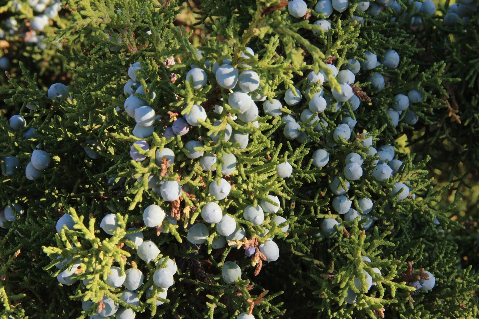
juniper berries
Just before Horseshoe Bend campground, we saw some more wild horses.  This mare with a colt and a foursome across the river.  Beth walked and took some photos while Greg replaced a latch which had broken on one of the cabinets – glad we had a spare! 


We went into Horseshoe Bend which is on a  lake formed by the Bighorn River.  Across the lake are red cliffs, which looked nice in the morning light.  Walked a bit and noted more rabbits and quite a few small lizards, like this one – about 5”. 


They had a dump station, so we emptied tanks and refilled the fresh water tank before moving on.

We are driving east, into the Bighorn Mountains now.  Very steep and steady climb with lots of switchbacks – 10 miles of a 10% grade!  We stopped at an overlook, looking out over the Bighorn Basin – a 140 mile long by 100 mile wide area surrounded by mountains: Beartooth and Absaroka to the west, Wind River and Owl Creek ranges to the south, Pryor mountains to the north, and the Bighorns to the east.


Medicine Mountain is our next stop, where we hike up to the Medicine Wheel.  This is a  circle of rocks atop the mountain that was built long ago.  It continues to be a very spiritual place for over 50 different Indian tribes and the Forest Service helps to protect it. 


Adam, a ranger stationed up there, says there are ceremonies held there almost daily.  Lots of prayer flags, small pouches, and all sorts of offerings are attached to the ropes surrounding the stone circle.  There are many other remnants of Medicine Wheels throughout the mountains, but this is a well known and well preserved one.

We see a few fossils in the rocks on the way back to the parking area.


We are thinking we will stop at a visitor’s center at Burgess Junction, but it turns out that it has been closed for several years, so we turn south toward Shell Canyon.  Nice drive through tall pine forests but it is a warm day and wildlife is probably laying low.  Deer, elk, moose and some bears are resting in the shade today.

Next stop is Shell Falls and an interpretive center.  The Falls are nice and there are several hummingbird feeders by the building. 


They have four different types and we see two while we are there – I think they are black chinned and roufus. Helpful ranger lady shows us some maps and suggested camping spots.  We continue through the  Canyon and finally leave the mountains and forests near the town of Greybull.  There is a rough road called Red Gulch road that we plan to take, but we pass it to go into Greybull where we get gas and a few groceries.  Lots of irrigation here , with sorghum, sunflowers, and hay.The temperature has passed 93 as we head back to Red Gulch road.  5 miles in, there is a dinosaur track site so we decide to go there and then decide whether to continue on dirt for another 30 miles or not. 
 

We are in rocky, brush covered land, a few rock formations being the only break.  We reach the dinosaur track site and do a boardwalk to see the tracks. 


They are not easy to see, so we use our imaginations. Lots of signs warning about rattlesnakes, scorpions and lizards, so we decide to head back the way we came to the mountains for some cooler temps.

We remember seeing a campsite back before Shell Falls, so head that way and are fortunate to get the last site, #14 of 14.  The sun is still brutal, but in the shade it is comfortable.  Just a few yards away there are many trees and a nice stream – green grasses, moss and ferns – a completely different world!  Chef salads for dinner.


The full moon lights the landscape and few stars can compete. Slept well.


Cody, WY July 28, 2015

Tuesday, July 28, 2015
Cody

There is snow on the surrounding mountain tops this morning and our temp at 7AM is 34 degrees. 


We decide to try Lamar Valley again, so go back into Yellowstone.  Lots of bison and they are active this morning.  Most are moving to the other side of the river, so we watch them cross. 

We scout for wolves in the area we were told they frequent, but nothing this morning,  so we head back to the Beartooth highway. We see a sign that says the road is closed, but continue another 20 miles before we come to a barricade.  We later learn it was closed because of snow and hail storm!


A type of sparrow breakfasting on seeds.
 

Beautiful high country, it was 34 degrees at 11AM!  Some lovely wildflowers and clear blue lakes.

Since we can’t continue on, we decide to go to Cody a day earlier than planned, and we take the Chief Joseph Scenic Highway which twists and turns through the mountains.  It is extremely windy, so much so at Dead Indian Vista Point that we can barely stand! Dead Indian Mountain is named so because when the Nez Perce were trying to escape to Canada, they left a wounded indian here and the pursuing army killed him.


I text Sandy as soon as we have signal but only an hour or so away, and she replies that Skylar is home and we should make ourselves at home.   We are greeted by a surprised Skylar and Paul shows up a few minutes later to say hello – his business is just down the road.  We shower and clean up the Trek a bit.  We will sleep in the little guest room Paul has built over his workshop, complete with bathroom and shower!  Very nice.
Skylar with Rue (small) and Buddy 

Sandy and Paul come home around 4:30 and we all go out for pizza and then play some Golf (card game).  Parker plays his guitar for us while we play. Fun to hear what everyone is up to but tomorrow is a work day so we call it quits around 10:00 and sleep well.

Wednesday, July 29
Cody

Up early to say hi to Sandy and Paul before they leave for work.  I use their wi-fi for a while, catching up a bit on emails, blog, etc.  Then Greg and I go to the post office and grocery store and get things for tonight’s dinner  - chicken and shrimp fajitas, guacamole, and a bean/corn/peach salsa dish Sandy has on hand.   Paul and Sandy both come home for lunch, so we finish off last night’s pizza.  Later,  Skylar goes with us to run a few errands, including a stop at Pete’s Café for some yummy ice cream. She shows us some of the painted buffalo and bears throughout town.


 They live close to the airport and on the way home we noticed a small plane that was nose down – ambulance and firetrucks there but we later learned there were no injuries, just strong winds.

We share pictures of Thailand with Ky and she shows us pictures she has taken.  She is a mature 13 and filled us in on school, flute and piano playing, girl scouts and more.  Parker, at 14, has a summer job helping do roofing with a relative’s company.  Ky does a lot of babysitting.

We played some cribbage with Ky – she loves games and is good at most of them!
When Sandy got home we got dinner going and ate on the back patio – really pleasant evening! Parker’s friend Casey joined us as he and Parker are on a bike team and have a big ride tomorrow morning. 
Parker (with new hat), Skylar, Paul and Sandy Luthy


Took a few photos, then had angel food cake with assorted berries for desert.

Another round of Golf and good chatter. What a healthy, happy family!


Thursday, July 30
More Montana and Wyoming

We decide to head for Red Lodge this morning after saying goodbye to everyone. It is 64 degrees at 8 AM and is supposed to get to 90!  Good we are heading for the mountains!

Sandy told us about an eating place in Red Lodge called Regis Café, so we decide we’ll stop there for a late breakfast. 

We arrive around 9AM and the place is very busy.  They are big into local and organic foods.  Greg has a fresh basil omelet which also has potatoes, peppers, zucchini, onion and cheese.   I have a similar dish with banana bread.  Very tasty!  Their raspberry jam was to die for!

We pass a few flocks of white pelicans on the Shoshone River.


Stop to read about the Smith Mine Disaster where 74 miners died in a methane explosion in 1943.

Many many motorcycles everywhere the past few days.  The big rally at Sturgis is coming up next week and apparently lots of folks are touring before the rally.  Greg says it seems most riders are 60+.  Many three wheelers as well.

We take the Beartooth Scenic Highway back to where it had been closed, going over some beautiful mountains, passes, lakes, etc.  Absolutely gorgeous! Bear Tooth Pass, the highest point, is 10,947’. 


We later stop at Clay Butte Fire Tower and climb up to a no-longer-used tower.  Nice views and the volunteers managing it are an interesting couple from Minnesota.


The geology is amazing as we read about 500 million year old sea beds, upheavals, faults, folds, glaciers, etc. that formed this land. We are but a tiny speck in the history that unfolds daily.

We have to go back down the Chief Joseph Scenic Highway towards Cody – not a whole lot of roads to choose from around here!  Then we head west again toward the Bighorn Mountains.  We pass irrigated farmland with sunflowers and other crops,  pastureland with horses, cattle and sheep.  A few jack-up rigs too.


We reach Bighorn Canyon National Recreational Area and after stopping at a Visitor’s Center, decide to head to a campground there.  The Bighorn River parallels the road and there are trees by the river, but most of the land is rocky, almost desert-like.  We go through the Pryor Mountain Wild Horse Range and decide we will go back out after we find a campsite and look for mustangs.

We stop at Devil’s Canyon outlook on the way north. 

Wow!  Incredible carved canyons! 

There are a few deer and lots of rabbits as we continue on.  We discover there was a recent fire in the canyon leading down to the campground.  Not a huge area, but you can still smell the smoke and see charred trees.  The damaged area ends just before the campground begins.  Not a lot of sites, many are tent only, but not many people either.  There are about 4 sites being used out of maybe 20.  


We find a site and then head back out the road where someone told us horses sometimes like to hang out in the evenings.  More deer and rabbits and we come around a bend and see something dash across the road from brush into brush.  It moved so fast we aren’t sure what it was but think it may have been a mountain lion! Definitely looked large and feline.  Greg stops and we wait a while to see if it will re-appear, but it is gone.

We turn back for the campground and see several of the wild mustangs sauntering through the brush/grass having dinner. 

The wild horses here can be traced back to the stock brought to America by the Spanish.  We watch them graze for a while and they cross the road in front of us and continue on.  One black stallion, a mare and a young horse.

Back to the campsite and a beautiful full moon rises.  We have worst for dinner and it has cooled off nicely, though we don’t need blankets till morning!