January 25, Monday
We camped on Dome Road on the west side of Quartzite, so
easily got on I-10 in the morning, heading west. Crossed the California border about 8:15 and
stopped at the small town of Blythe, where we found gas and a nice Albertson’s
grocery store.
California desert looks pretty much like Arizona desert. Mesquite and creosote bushes, occasional cacti. Lots of traffic on this road but interesting that
the speed limit for 18-wheelers is only 55. We actually spent some time in the passing lane!
We headed to Joshua Tree National Park, where we stopped at
the Visitor’s Center, watched a film and talked with a ranger. The Park is large and contains parts of both
the Mojave Desert (north)and the Colorado Desert(south). We are at the southern tip and most of the camping and trails are north. Not much in the south – many yuccas, but no
Joshua Trees. The road to the north is steadily but not steeply uphill, with plant life changing at different elevations.
Then we came to the cholla cactus garden – they sure must like this elevation! They are sometimes referred to as jumping cactus. The branches are jointed and the outer joints very easily catch on any passing person or animal. Must be beautiful when they are all blooming (red).
These joints also sometime detach and in favorable conditions form the start of a new plant.

Next stop is at White Tanks Campground where we find the
trailhead to Arch Rock. We follow the
trail through huge boulders, narrow passes, overhangs, etc. till we reach Arch Rock.
From here we head out to Cap Rock nature trail, a quick
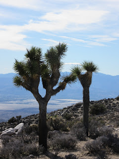
loop, and then to Keys View, the highest point in the Park. Lots of Joshua trees at Cap Rock.
The wind is cold too, so we do a quick photo and head back to the Trek for some lunch. Funny to watch people arrive, go up the trail for the view and hurry or even run back to their vehicles! Okay, I admit, I ran.
We go a little further north to Hidden Valley Campground,
where we snag a site and pay our fee. The
campground is nearly full and most of the folks seem to be Californians.
This is near Baker Dam, which is one of few
places with water in the park.
Originally built by cowboys for an area to water their cattle, it still
holds water during much of the year.
There were quite a few people hiking the trail, so we weren’t surprised
that we didn’t see any wildlife, save a few birds.
Back to camp, we watched a few people rock climbing – both
free-style and with equipment.
Apparently this is a good park for this activity! We had dinner and read. I have finished the Wallace Stegner book Crossing to Safety– I really like his
work. Greg finished his Eisenhower
book. I am now reading Eric
Larson’s book about the sinking of the Luisitania. Greg is taking a break from history, reading
something about exercising and life style called Younger Next Year. Sunset and dinner.


No comments:
Post a Comment