Search This Blog

Wednesday, November 27, 2013

November 20, 2013 Big Bend

November 20

Beautiful orange sunrise, 57 degrees.  We bade farewell to the Chisos Mountains and headed out of the park towards Study Butte.  Passed an area they call the badlands
 and next stop is the town of Terlingua, home of the world-famous  (well, Texas-famous anyway) chili cook-off.

The town is partly ghost town and partly occupied.  There used to be quite a mining operation for quicksilver (mercury).  Many adobe ruins and a fantastic old cemetery.


The Trading Post is an interesting store next to the old Starlight Theater,  filled with arts and crafts, food and clothes.  Many locally made items, along with the made in China variety.  Can't help wondering what these people in China think as they are making roadrunners, cacti, smiling hot chili peppers, pinatas, etc.


A bit further on we turn onto the River Road (Paseo Rio), which runs along the Rio Grande, which is the US/Mexico border,  to Presidio.   We see an occasional Border Patrol car, but seriously, it would be easy to cross at many points.

 The State of Texas has recently added a State Park which is adjacent to Big Bend National Park and we stop at their visitor's center to have a look around and chat with the rangers there.  They mention a slot canyon trail that is spectacular and quite unusual for this part of the country, as well as several other trails.

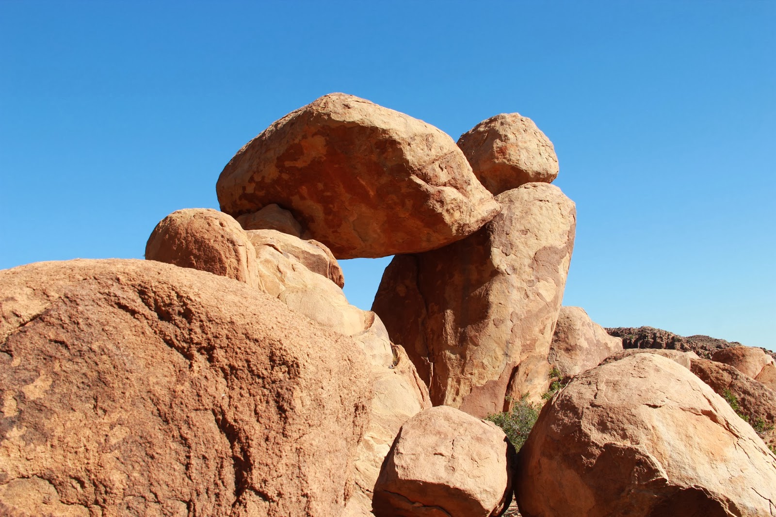
Closed Canyon is a slot canyon carved into the lava tuff (most slot canyons are in sandstone in Utah).
It is very long and makes us feel very small as we wonder between the tall canyon walls.  Only a few puddles of water but the floor is mostly smooth polished rock.  At places, the canyon is only 6-10 feet wide.  It is about 20 degrees cooler here where the sun doesn't reach.  It is near 80 degrees back by the parking lot. Amazing what the force of water can do, it is impossible to capture the grandeur of this spot with a camera. (Doesn't keep me from trying….repeatedly…:)


  The road is like a roller coaster and at one point we come over a hill and nearly run into a herd of goats.  They are large, white and brown, and totally unconcerned with this 8000 lb vehicle bearing down on them.

We finally reach Presidio, a very small town where we thought we'd have lunch.  El Patio seems to be the only show in town, so we stop there for some Mexican fare.  Though our waitress doesn't speak English, we manage to communicate and enjoy a nice lunch complete with enchilada, quesadillo, chile releno, beans and rice.  Mine is good, Greg's is "ok", but his comes back to visit later :(.

We head north from here and pass another mining ghost town before we reach Marfa.  Known for artists and "the Marfa lights" and setting for the old film "Giant". Nice court house.
 We try to see Building 98 where WWII German POWs painted murals on their walls, but unfortunately the building is closed. Chinati foundation is an artist coop area with some wild art, but we have missed the last tour and settle for looking at some big concrete blocks outside - art? I'm sure we just don't understand... We look around in a few galleries/shops in town and then head for a viewing area for the Marfa Lights, where, we are told, we can boondock.  Supposedly these mysterious unexplained lights appear in the sky most nights just after dusk.  There are myriad possible explanations from swamp gas to rock dust to car headlights to aliens but no one knows for sure….(cue twilight zone music).

They have a nice viewing pavilion with rest rooms and telescopes.
 By dusk there are quite a few people here but most drift away disappointed an hour or so later.  I set up the camera to capture the lights and except for two quick flashes of green, we see nothing except a nice sunset and nice moon rise.


 Marfa Lights?
 A little while later we learn that there are railroad tracks on the other side of the highway, which we are reminded of a few times during the night.

November 21
Nice sunrise in Marfa. When we get out of the Trek we see a Border Patrol car has parked nearby and an officer is walking the nearby fence line.  We move on down the road  about 25 miles to the town of Alpine - real metropolis compared to what we've been seeing.  A few traffic lights even, and home to Sul Ross University (about 2000 students).  We are early for the Museum of the Big Bend on the university's pretty campus, so we bypass McDonald's and go to Penny's Diner for a hearty breakfast.  We are the only customers, which is a little worrisome, but five or six others soon join us and the food is good.

We arrive at the Museum just after it opened at 9AM and are greeted by a few friendly folks who explain the building and layout.

 There are many exhibits about the early inhabitants of the area, the Apaches, and those who struggled to make a home in this rugged, inhospitable land.  There is also an exhibit of works by Frederick Remington, including several dozen paintings and 6 gorgeous bronzes.
Nicely done.


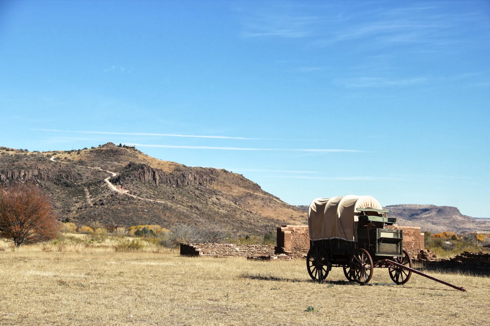
After Alpine, we head to Fort Davis and stop at the Fort Davis Historical Park which has a dozen or so buildings from the 1800's, including a hospital, enlisted men's barracks, an officer's home and commissary.  Feeding a few hundred men as well as their horses was not an easy feat!


 Quite a few Buffalo Soldiers were posted here after the Civil War.

Next we begin to climb into the Davis Mountains, headed for a tour at McDonald Observatory.  We watch a film and some live coverage of the sun, then take a shuttle to see several of the huge telescopes housed here.  Kevin, our guide, was excellent. The dark sky here is one reason for the success of the Observatory.  There are actually county regulations as to what types of lighting are allowed within a 70-mile radius of the observatory.   Kevin joked that there are a total of about 80 people who live "on the mountain" and work here, making this the 4th largest community in the county.


 One of the smaller of the telescopes.

We finished near 5:00, so stopped at an apparently abandoned rest area part way back down the mountain and boondocked here.  Chicken, mashed potatoes and corn for a nice dinner.  It is getting cold, though, so we spend little time outside. Nice quiet spot.

November 22

7:15AM. Wake to 27 degrees and wind with a light mist.  Brrrrrr.

The folks at the observatory told us the forecast didn't look good, as they were predicting their first dose of wintery weather with possible ice and snow.  We were considering staying for a star viewing party tonight, but with this weather, visibility will no doubt be nil, so we decide to call it a trip and begin the long haul home.

It isn't until noon that we finally hit temperatures above freezing, though the mist and wind continue and we have quite a build-up of ice on the windshield wipers, mirrors, antennae, etc. until we get close to Houston.   Long drive with only stops for gas and we finally get back home around 6:30 PM. After almost 2,000 miles, a hot shower and our own bed sure feels good :).


November 19
In the 50's again this morning.  We have a leisurely breakfast and then set our sites on Grapevine Trail, which someone recommended to Greg yesterday.  We stop by the visitor's center, and see a few deer on the way out of the basin.

A rough 7 mile road to the trailhead.  We pass the landfill for the area which is almost invisible except for signs and a big piece of equipment.  Lots of crows in the area, though, so there must be some "pickings".

We are the only car at the trailhead, so have a nice quiet walk.  Lots of neat rock formations and part of the trail follows a dry river bed until it begins to climb.  Fortunately there are trail signs because it would be easy to get lost amongst the boulders!  At the end of trail is a balancing rock formation.  We wonder around a bit, taking pictures and taking in the scenery.  After 10 minutes or so, some more hikers arrive and we have a drink and then wind our way back.


 Look closely at the above picture and you may see some hikers on the trail down in the valley.


We escape out the road with only one little scrape - Greg is great at maneuvering these roads.
We stop for fuel at Panther Junction ($3.65 compared to $2.85 at home!) and then make the drive back to Rio Grande for a shower and to re-charge the laptop while we have some sandwiches.  Back to our campsite and we decide to tackle the Window Trail - we are leaving a little late and won't have time to dally if we want to get back before dark.

The trail starts out downhill into the valley, then levels nicely.  More brush and bushes in this area, still lots of rocks.

 This trail is noted for wildlife and about half way in, we spot a mother bear (black)with 3 cubs.  This is the bear we heard about that lost a cub a few weeks ago to a car accident. Fortunately they are climbing away from us, so we just enjoy watching them for a while. There are only 20 or so in the entire park, so we count ourselves lucky to have seen them. 100 yards down the trail we come  across some fresh bear scat - we didn't miss running into them by much!


We chat with a few other hikers we encounter and hear tales of huge scorpions and a rattlesnake further down the trail, but we don't encounter either. Whew!

The trail climbs through a rocky gorge and ends at another pour off with a steep drop.  If Greg walked forward a few feet in the picture below he would have a long hard fall. This is what is called "The Window".

Not much water today but it is a beautiful site nonetheless.  I am antsy about getting back before dark so we don't dally.  We reach camp just as the very last bit of sun disappears - didn't have to resort to the flashlight!

Amazing stars from horizon to horizon, and the full-ish moon is late rising tonight so they are all the more visible.  We use the Night Sky ap on my phone to identify some of the formations and planets - Venus is prominent. Too tired to try taking photos…. we enjoy some cheese and crackers and a drink, then finish off the kielbassi and hit the hay!

Monday, November 25, 2013

November 18, 2013 Big Bend

November 18

Cell phone coverage is almost nonexistent, though we have found it at two odd places along the roadway.  The lodge and the store at Rio Grande Campground have wi-fi, but not phone service.

It is 52 degrees at 7:30 this morning.  We stop by the visitor's center to clean up with their hot water facilities, then head for the Ross Maxwell Scenic Highway, which goes from the Chisos Mountains down to the Santa Elena Canyon.  We stop at the Sam Nail Ranch, another abandoned homestead with windmill, a few building remnants and pecan trees which are a brilliant yellow.


We arrive at Santa Elena Canyon Trail about 9:30AM and hike into the canyon, climbing and then descending to the water.  It is very quiet and we are the only people around until we pass a threesome as we are leaving.  The canyon walls tower above the emerald Rio Grande, at times reflecting the fluffy white cotton ball clouds.  A geologist's dream, we can only comment on interesting rocks, faults, and boulders.


We make several stops on the return trip.  Durgan-Sublett House shows the amazing 12" thick walls with stone on the exterior and adobe inside.  Coyote tracks nearby.


Next stop is Castalon Visitors' Center and we reminisce about visiting there 30 years ago with a 3-year-old Bryan.  Orange Crush treat from the tiny store to accompany our sandwich lunch.  Tuff Canyon overlook showcases a deep canyon through white lava rock.

Mule Ears Overlook is self explanatory.

We hike about 2 miles through the desert on the Chimneys Trail before deciding it isn't worth it and instead continue to the Burro Mesa Pouroff, recommended by the ranger at Castalon.  This trail has some interesting rock formations that lead to a huge bore in a cliff which is where all the water from the area drains.  It is dry now, but there are signs throughout the park warning about flash floods and it seems that especially in Summer they get some real "gully-washers".


See several deer - the Carmen White Tails - along the highway.


We go to the lodge for dinner, as we did 30 years ago, and Greg has a burger and fries, as we did 30 years ago!  There are several cabins and a motel nearby, so quite a few diners.

There is a Texas Outdoor Woman's Network group camping at our campground - the Austin Chapter - and Greg finagles a look at one of their Casita RV's, which he pronounces very well-designed.