Search This Blog

Tuesday, July 30, 2013

July 26, 2014 Boise and Idaho


Friday, July 26

Cereal with the remaining raspberries for breakfast and then we hit the road to make up some miles.  The land is flat to rolling hills, farms for a while.  Wheat fields , hay and a few other crops. Then we reach McCall and Lake Payette – very upscale touristy area with lots of traffic.  We continue on and things get more mountainous again.  We stop at Snake River Canyon,


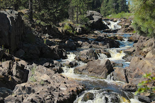
and then along the Payette Scenic Hiway which runs almost right next to the Payette River.  Lots of evergreens, for a while.  Beautiful falls and rapids.We cross the 45th parallel, which is half way between the equator and north pole.


Then we are back to farmland and prairie. We go through downtown Boise and their beautiful capital building  and stop for gas near Boise State University.(No blue grass!)  Also make a stop to replenish the fruit supplies with local cherries, peaches and raspberries!

As we head south to Utah, the terrain becomes more sagebrush and prairie with rolling hills. Occasional farms with irrigation, but looking pretty desolate.   
We pass the welcome to Utah sign and see several deer and antelope (enjoying the irrigated grasses).  Near Ogden, we stop at a nice Walmart.  It is 90 degrees at 9:00 PM! Does cool down, eventually.


Monday, July 29, 2013

July 24 Palouse, Hell's Canyon,


Wednesday, July 24

Drove some back roads to Palouse which were suggested by a local photographer.  More wheat fields and neat contours.  Some hay as well.  Heard later that they can get three cuttings of hay in one season, which is why some is long, some short, some green. Scenic highway back and forth from Idaho to Washington.


Decided to visit Hell’s Gate State Park and their Lewis and Clark Discovery Center.  Lots of information about Lewis and Clark’s expedition, particularly in this area.

Nice park.  We decided to book a jet boat tour tomorrow that leaves from the marina here, so will stay in the park.   In the meantime we went into Lewiston and used their wi-fi at the library.  Fabulously fast!  From there we visited the Nez Perce National Historic Park, which the librarians recommended.  Good displays, a film and other information about the Nez Perce.


Back to Hell’s Gate and we watched a film at the Lewis and Clark center.  Very hot day – 100 plus – so an inside movie was good!   Showered and ate and visited with two school teachers from Maryland who were tenting across the way.

Thursday, July 25, 2013

Rose early and took care of housekeeping, then went to the Marina for our boat trip.  There were 12 of us on a boat that will hold 22, so very comfortable.  Two 375HP motors and shallow – like an air boat on steroids.  The morning is cool, but it will no doubt be over 100 again later, so this is a good place to be.  (There is a cover!)

All of the trip will be on the Snake river, which varies from 2 to 120 feet in depth and has some class IV and V rapids (the wildest). We will travel 96 miles each way.

Mountains to either side of us, very rocky and dry.  There are some trees and grasses right along the river and we spot a coyote and then several groups of mule deer.  Occasional rapids, but nothing too wild.

We stop an hour and a half in for “breakfast” of coffee, juice and muffins at a house used by Fish and Game for issuing permits.  Only 29 boats are allowed per day.
There are some mule deer here and a group of wild turkeys near by.


We begin to see people in rafts, kayaks and other boats.  Some are on multi-day trips and have separate rafts carrying supplies.  The first time we get wet is when we meet a raft full of guys with water guns!  The next time is as we are bouncing through some rapids. 


Nate, our pilot, has been doing this for years and obviously knows the river well as he avoids rocks, sand bars and shallows with ease.

There are neat geological features along the way including basalt columns, shiny rocks with manganese oxide,  white layers from ash from the volcano that formed Crater Lake, and more.  Some sandy beaches.  There are occasional cabins and Nate explains who built them and how they got the supplies there, etc.


At lunchtime we stop at an old Lodge, run by Nate’s Dad.  Nice box lunches and we are entertained by hummingbirds.  We see a mail boat which delivers mail ton Wednesdays to boxes that folks put along the river.


The rapids are getting more frequent and bigger and before long we are entering Hells Canyon.  Some very large mountains and narrow river – at one point deeper than the grand canyon!  We see big horn sheep at several spots.  We go through two class IV rapids with 6-8 foot waves!  Everyone gets wet.  After the last one, we come to our turnaround spot and are warned that going back is bumpier and wetter and we should protect cameras, etc.  (I brought a plastic bag).  They were right!  Totally drenched.


Made a few stops on the return trip, at an old farm, some petroglyphs, and a spot where 16 Chinese were massacred by cattle thiefs.  Nate and Ty, his assistant, show off their jumping skills here.

  Now Nate is controlling the boat to target drenching certain people, and he’s pretty good at it – all in fun.

We reach the marina about 5:00,  decide to stay at this campsite again, shower, eat a sandwich, talk with neighbors again and crash.

Wednesday, July 24, 2013

July 23, 2013 Canada to Washington and Idaho


Tuesday, July 23

Finished winding our way along route 3.  In Greenwood, several folks had altered their flags so they were half Canadian and half US, since the town straddles the border.  Signs confusing as we approached Grand Forks, BC, so we asked a local and ended up inadvertently taking a smaller backroad across the border at Danville.

Customs guy was nice.  He did come “on board” and briefly checked the fridge and a cabinet or two but all he confiscated was one orange.  Thankfully he didn’t comment on the rest of the fruit. Said this route would work, we’d just have to go over Sherman’s Pass.  No biggie, right? Sherman’s pass involved about 25 consecutive miles up mountains, and then the same coming down.  Had to stop to let engine cool going up and brakes cool coming down.

 Lots of signs for free range livestock lately, but we didn’t encounter any.

Stopped in a small town called Colville to get gas and asked the few people in the gas station what there was interesting to see in the area.  Got directed to some waterfalls, Crystal Falls, which were ok.  Followed a sign for Wildlife Viewing and saw deer and a duck.


Beginning to see fields of wheat and more rolling hills than mountains.  Not so much irrigation.  Still a good many lumber trucks and processing plants.


Stopped at The Pizza Factory in Deer Park, north of Spokane for a good buffet with salads and pizza.  They hand tossed their pizzas.

Next stop Coeur d’Alene, where we parked downtown and walked around.  Lake Coeur d’Alene is quite large and was really busy today, with temperatures around 90. They had a nice boardwalk around the harbor and there were people doing about anything you can do in water, from swimming to pontoon airplanes.


Note the plane

 Took these shots of the "amber waves of grain" near Worley.


Stopped for the night in Moscow, Idaho , home of University of Idaho.  Camped at a Walmart that had a huge lot where we had our own “wing” and made plans for tomorrow.


July 21 Prince George, south, Fruit


Sunday, July 21, 2013

53 degrees this morning but nice and sunny as we continued south on 97.  We are seeing more hayfields and lots of logging and wood processing facilities – saw mills, pulp mills, planer mills, plywood plants,  huge lots of logs and now we see signs that show logging trucks along with the tractor signs.


Arrived at Prince George and stopped at Fort George Park, a very nice city park with gardens, a small train, a water playground and native cemetery. 


  Continued on to tiny town of Hixton where we were told there was a very nice waterfalls.  Stopped at a flea market for directions.  Yet another windy, rutted gravel road for Greg to maneuver over!  We stopped and walked the last part of the road and then the trail to the Falls.  A fair number of locals – the man at the flea market said “everyone and his dog” would be there since it was not (74 degrees).  There were lots of dogs.


The Falls were nice and we got our cardio workout for the day.

Beginning to see more irrigation and read that the land is fertile but dry – just add water and they can grow anything!  Stopped for some “Fresh B.C. Cherries” – yum.

Williams Lake has a ranch and rodeo museum and we are seeing advertisements for rodeos in many of the small towns.    Many of the towns  on this road are named for how far they were from the start of an old  stagecoach route, so we passed through 150 Mile House, 108 Mile Ranch, 100 Mile House, etc.  Random buildings along the way will have the mile painted on them.  We stopped for the night at 100Mile Hotel & RV Park.  They had showers and a few washers and dryer, so we got everything cleaned. Here are two of our more colorful neighbors. 
Wi-fi was terrific outside so I got caught up on the blog.  Gourmet canned beef stew for dinner.


Monday, July 22, 2013

Blueberry pancakes this morning before we hit the road again.  First stop was Chasm Provincial Park, north of Clinton.  This was a neat canyon with lots of color layers due to old lava flows.


Next we took a side road to Loon Lake.  Silly me thought there might be loons there – it was a windy road with some steep hills and canyons. 
The lake was huge and very developed with cabins, fishing resorts, etc.  Mostly pretty rustic, but some gorgeous homes.  No loons.  We did see this sweet deer with a fawn on the way back.


Came to the "Painted Hills", nice views.

 But most of the hills were more like this.    Can you spot the train?

The countryside has become very dry – reminds us of Wyoming.  Lots of irrigation, though and green fields.  And occasional lakes.

After we reached Cache Creek and turned south, we began to see signs for fruit.  Had to stop at a U-Pick Raspberry place and paid $1 for a pint of berries. 
  The lady there said we picked the right time to come through BC.  The next 100 miles were filled with orchards and vineyards.  Apricots, Plums, Peaches, Blueberries and veggies too.  We got more cherries and some peaches too.


Signs say we are on the Winery Route and we must have passed at least 25-30 wineries before we got to the US border.  Also passed several very large lakes, like Kalamaka and Okanagan (nearly 80 miles long).  Many resorts and towns with the related businesses, retaurants, stores, malls, etc. – and traffic and traffic lights.  More lights today than we saw on the entire trip thusfar.

We stopped at Provincial Park near Osoyoo but it was full.  The camphost offered his parking spot, but for $21 we decided to find a free parking spot.  Turned onto Rt 3, thinking it would be less traffic, more rural, only to find ourselved climbing mountain after mountain.  The Trek, poor thing used to sea-level Houston, overheated and we had to stop for a while so had dinner.  Greg finally found a great boondock spot at 7:30 and we settled in.  Temperatures this afternoon hit the 90 mark – we want to turn  back to the North!